Dorchester North Burying Ground
Also known as: First Burying Ground in Dorchester

Why it's listed
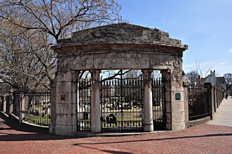
Dorchester North Burying Ground occupies 3.27 acres at the corner of Columbia Road and Stoughton Street in Boston's Dorchester neighborhood. Established in 1633, it was the settlement's only cemetery for two centuries and grew through several additions between 1694 and 1820. A concrete wall now encloses it, while earlier gates carry bronze tablets placed by the city in 1883. Paths laid out in 1834 divided the grounds into twenty-four sections, and the maple clusters date from that work. About 1,200 markers survive, ranging from curved 17th-century slabs to slender neoclassical stones of the Revolutionary era and varied Victorian monuments. The earliest existing stone in Boston's ancient burying grounds, for Abel and Submite Clarke, is here. Burials include Lieutenant Governor William Stoughton, the Reverend Richard Mather, and printer John Foster, along with forty unidentified soldiers who died during the Siege. The site was listed for its founding-era associations and its funerary art.
Significance in brief: The nomination argues it is locally significant for its link to Dorchester's founding citizens, its early 17th-century establishment, and its exceptional collection of 17th, 18th and 19th century funerary sculpture. It contains the earliest surviving gravestone in Boston's ancient burying grounds and remained in use well into the 19th century.
Machine-generated summary. This summary was generated by a language model from the official nomination document and has not been reviewed line by line by an editor. It may contain errors. Check the source document before relying on any detail. Source: nomination document (PDF) · National Archives catalog entry. NRHP reference 74000915, listed April 18, 1974. Summary generated October 2026 (model claude-sonnet-5-5, prompt v1.0-2026-10-29, confidence medium).
Key facts
| Address | Stroughton St. and Columbia Rd., Boston |
|---|---|
| County | Suffolk County |
| Listed | April 18, 1974 |
| Reference number | 74000915 |
| Resource type | District |
| Period of significance | 17th Century (specific date 1633); 18th and 19th centuries also discussed |
| Areas of significance | Landscape Architecture, Art, Social History |
| Level of significance | State |
| Status (as stated in the nomination) | Owned by the City of Boston Parks and Recreation Department; in use as a cemetery; condition listed as fair and unaltered. |
| Acreage | 3.3 |
| Within district | Uphams Corner Historic District |
| Coordinates | 42.31689, -71.06382 (NPS GIS) |
What listing means for this property
This is a historic district. Buildings within its boundary are either contributing (they add to the district's significance) or non-contributing. Owners of contributing income-producing buildings can claim the 20% federal rehabilitation tax credit; homeowners should look at state credits. National Register districts impose no design review by themselves; a local historic district ordinance, if one exists, does (the difference explained).
General information, not legal or tax advice. Rules change; confirm with your State Historic Preservation Office or a qualified adviser.
Sources and further reading
- National Park Service, National Register of Historic Places database (snapshot May 2026), reference 74000915.
- Nomination form (PDF, National Archives) — catalog entry
- Wikipedia article (used for cross-checking only; text not reproduced here)
- Wikidata Q5297613
- This listing as JSON
Last updated October 2026. Found an error? See the editorial policy for how to report it.