Plymouth Rock

Why it's listed
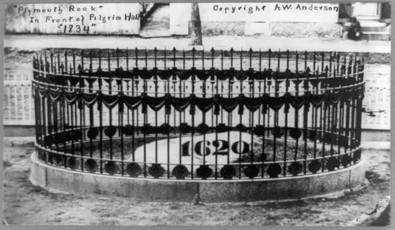
Plymouth Rock is a large granite boulder at the foot of Cole's Hill beside Plymouth Harbor in Massachusetts, now incised with the date 1620. It is regarded as the traditional symbol of the Pilgrims' landing and the first permanent English settlement in New England. In 1741, ninety-one-year-old Elder Thomas Faunce identified the stone, saying original settlers had pointed it out as the landing spot. The official Pilgrim records name no specific landing place, but the Rock's value as a symbol outweighs that question. The boulder split in 1774 during an attempt to move it to the town square. One half was later moved to Pilgrim Hall in 1834, and the halves were rejoined in 1880. Today the stone rests behind a granite seawall under a gray granite canopy by McKim, Mead and White, dedicated in 1921 and given to the Commonwealth by the National Society of Colonial Dames. Sixteen monolithic columns support the canopy.
Significance in brief: The Rock is the traditional symbol of the Pilgrims' landing and the founding of the first permanent English settlement in New England. It was identified in 1741 by Elder Thomas Faunce, and although the official Pilgrim records name no landing place, its value as a historic symbol outweighs the question of authenticity. The form also notes the canopy's architecture.
Machine-generated summary. This summary was generated by a language model from the official nomination document and has not been reviewed line by line by an editor. It may contain errors. Check the source document before relying on any detail. Source: nomination document (PDF) · National Archives catalog entry. NRHP reference 70000680, listed July 1, 1970. Summary generated October 2026 (model claude-sonnet-5-5, prompt v1.0-2026-10-29, confidence high).
Key facts
| Address | Water St., Plymouth |
|---|---|
| County | Plymouth County |
| Listed | July 1, 1970 |
| Reference number | 70000680 |
| Resource type | Object |
| Period of significance | 17th Century (specific dates 1620, 1741) |
| Architect / builder | McKim, Mead and White (canopy) |
| Architectural style | Classical canopy |
| Areas of significance | Exploration/Settlement, Architecture |
| Level of significance | National |
| Status (as stated in the nomination) | Condition listed as good; altered and moved; owned by the Commonwealth of Massachusetts and used as a historical site, park and museum. |
| Acreage | 0.9 |
| Coordinates | 41.95809, -70.66185 (NPS GIS) |
What listing means for this property
National Register listing is honorary: it recognises significance and does not restrict what a private owner may do without federal money or permits. It unlocks the 20% federal rehabilitation tax credit for income-producing buildings, state credits in many states, and Section 106 review when federal agencies are involved. See what listing means in practice.
General information, not legal or tax advice. Rules change; confirm with your State Historic Preservation Office or a qualified adviser.
Sources and further reading
- National Park Service, National Register of Historic Places database (snapshot May 2026), reference 70000680.
- Nomination form (PDF, National Archives) — catalog entry
- Wikipedia article (used for cross-checking only; text not reproduced here)
- Wikidata Q1072391
- This listing as JSON
Last updated October 2026. Found an error? See the editorial policy for how to report it.