Field, D.W., Park

Why it's listed
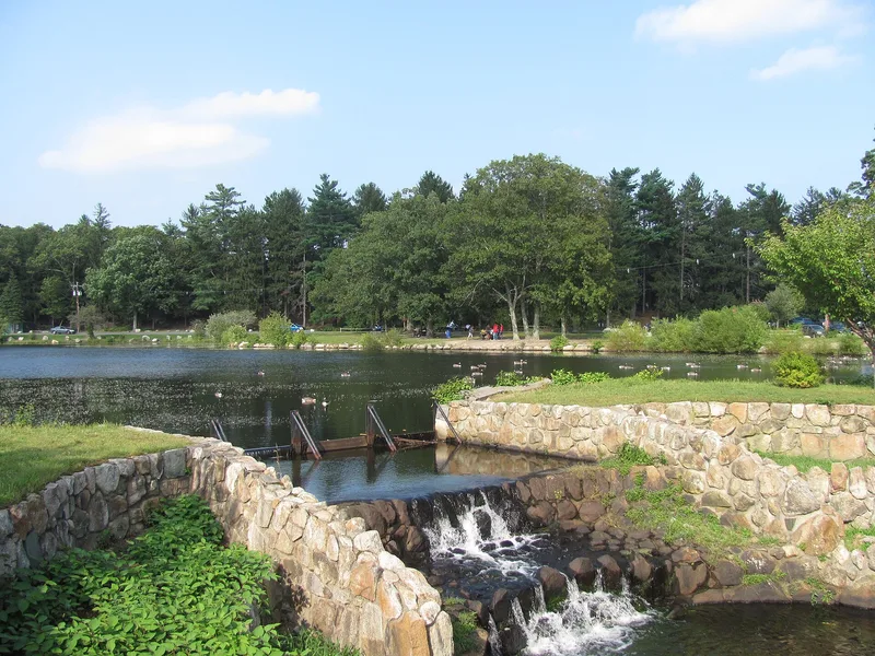
D.W. Field Park is a 650-acre public park spanning northern Brockton and southern Avon, Massachusetts. Laid out mainly between 1925 and the late 1930s, it was a gift from Brockton businessman Daniel Waldo Field, who had no children and regarded it as his legacy. Seven man-made ponds and lakes, covering 201 acres, form its core, ringed by a six-mile parkway meant for pleasure driving and bordered by woodland. A 1926 plan by Boston landscape architects Negus and Punchard, shaped by Olmsted-office training, guided Field's own on-site supervision. Features include a 60-foot stone observation tower built in 1928, fieldstone entrance piers, bridges and walls, many built by WPA workers, and a golf course begun in 1926. Ellis Brett Pond, once a popular swimming area, was drained in the 1970s because of pollution. The park is significant as a community landscape of the 1925-1944 period, ending with Field's death in 1944.
Significance in brief: The nomination presents the park as a landscape built by a local philanthropist for his community, with a naturalistic design that reflects Olmsted-influenced park planning, including a circuit parkway and linked waterways. It also notes the park's WPA-era construction and possible archaeological value. The period of significance closes with Field's death in 1944.
Machine-generated summary. This summary was generated by a language model from the official nomination document and has not been reviewed line by line by an editor. It may contain errors. Check the source document before relying on any detail. Source: nomination document (PDF) · National Archives catalog entry. NRHP reference 00001341, listed November 24, 2000. Summary generated October 2026 (model claude-sonnet-5-5, prompt v1.0-2026-10-29, confidence medium).
Key facts
| Address | Bet. Pond St., Avon and Pleasant St., Brockton |
|---|---|
| County | Plymouth County |
| Listed | November 24, 2000 |
| Reference number | 00001341 |
| Resource type | Site |
| Period of significance | 1925-1944 |
| Architect / builder | Preliminary plan by Samuel P. Negus and William H. Punchard (1926); built under D.W. Field's supervision; contractors included Sawyer Construction, Warren Bros. Co., and H.F. Johnson; Brockton City Engineering Department designed some structures |
| Areas of significance | Community Planning and Development, Conservation, Landscape Architecture, Social History |
| Level of significance | Local |
| Status (as stated in the nomination) | The park remains in use as public recreation space. The parkway is largely intact and in relatively good condition. Ellis Brett Pond was drained in the 1970s because of water quality problems, and the reservoir gate house is no longer used. |
| Acreage | 650 |
| Coordinates | 42.10104, -71.04415 (NPS GIS) |
What listing means for this property
Sites (archaeological sites, battlefields, landscapes) are often listed with a restricted address to protect them from looting or disturbance. Listing is honorary for private owners; federal undertakings on or near the site go through Section 106 review, and state laws may protect burials and artefacts regardless of listing.
General information, not legal or tax advice. Rules change; confirm with your State Historic Preservation Office or a qualified adviser.
Sources and further reading
- National Park Service, National Register of Historic Places database (snapshot May 2026), reference 00001341.
- Nomination form (PDF, National Archives) — catalog entry
- Wikipedia article (used for cross-checking only; text not reproduced here)
- Wikidata Q5203460
- This listing as JSON
Last updated October 2026. Found an error? See the editorial policy for how to report it.