Vine Lake Cemetery

Why it's listed
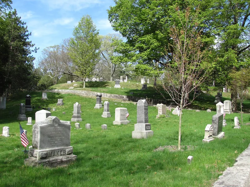
Vine Lake Cemetery, on Main Street in Medfield, Massachusetts, began as a small burying ground in 1651 and now covers 31.9 acres in nearly twenty sections. The town added land over time, and each addition brought a new landscape style while the older sections were kept intact. The result moves from the Colonial burying ground of Section A, through the winding roads and family plots of the Rural cemetery sections, to Landscape Lawn areas. Vine Lake, created around 1800 by widening Vine Brook and building a dam, gives the grounds their name and their main views. Section A contains slate gravestones from the 1690s, many carved by well-known Boston and regional carvers, plus marble, sandstone, granite and white bronze monuments, an 1844 receiving tomb, granite walls and a granite bridge from 1890. The nomination also notes possible Native American and early colonial archaeological resources beneath the grounds.
Significance in brief: The nomination argues the cemetery is a virtual microcosm of cemetery design, with Colonial, Rural and Landscape Lawn sections blending together. Section A holds early gravestones by noted Boston and regional carvers, along with fine 19th-century monuments. The site also has potential archaeological significance for both Native American and early colonial settlement.
Machine-generated summary. This summary was generated by a language model from the official nomination document and has not been reviewed line by line by an editor. It may contain errors. Check the source document before relying on any detail. Source: nomination document (PDF) · National Archives catalog entry. NRHP reference 05000277, listed April 14, 2005. Summary generated October 2026 (model claude-sonnet-5-5, prompt v1.0-2026-10-29, confidence medium).
Key facts
| Address | Main St., Medfield |
|---|---|
| County | Norfolk County |
| Listed | April 14, 2005 |
| Reference number | 05000277 |
| Resource type | Site |
| Architectural style | Colonial, Rural Cemetery and Landscape Lawn cemetery design periods |
| Areas of significance | Art, Communications, Social History |
| Level of significance | Local |
| Status (as stated in the nomination) | Still in use as the town's public cemetery; a Preservation & Management Plan was completed in 2004. |
| Acreage | 31.9 |
| Coordinates | 42.18712, -71.31573 (NPS GIS) |
What listing means for this property
Sites (archaeological sites, battlefields, landscapes) are often listed with a restricted address to protect them from looting or disturbance. Listing is honorary for private owners; federal undertakings on or near the site go through Section 106 review, and state laws may protect burials and artefacts regardless of listing.
General information, not legal or tax advice. Rules change; confirm with your State Historic Preservation Office or a qualified adviser.
Sources and further reading
- National Park Service, National Register of Historic Places database (snapshot May 2026), reference 05000277.
- Nomination form (PDF, National Archives) — catalog entry
- Wikipedia article (used for cross-checking only; text not reproduced here)
- Wikidata Q7932377
- This listing as JSON
Last updated October 2026. Found an error? See the editorial policy for how to report it.