Hutchinson's, Gov. Thomas, Ha-ha

Why it's listed
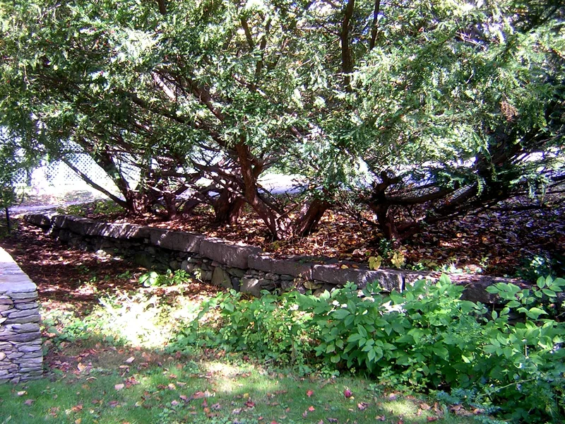
Behind St. Michael's Church on Randolph Avenue in Milton, Massachusetts, a stone-lined ditch runs north to south for about 120 feet. This is a ha-ha, a sunken barrier meant to keep wandering cows out of a garden without blocking the view of the landscape beyond. Its slanted sides are built of puddingstone and granite rubble and topped with large cut granite blocks. It is thought to date from about 1771 and to have been built by Thomas Hutchinson, then Provincial Governor of Massachusetts, soon after Horace Walpole's published description of the feature. Hutchinson bought the Milton property in 1742 and was admired even by his rival John Adams for his garden and horticultural knowledge. The ha-ha is the last surviving feature of his estate apart from foliage and land, and one of very few visible examples in the United States. It now stands deteriorated, with fallen stones and debris, and a 20th-century house occupies the former garden. Restoration of the ha-ha has been planned.
Significance in brief: It is the last surviving feature, apart from foliage and land, of Governor Thomas Hutchinson's estate, and one of the few visible ha-has in New England and the United States. It illustrates the fashionable formal garden design of the late 18th century. It is also tied to Hutchinson, a colonial official, historian and horticulturist.
Machine-generated summary. This summary was generated by a language model from the official nomination document and has not been reviewed line by line by an editor. It may contain errors. Check the source document before relying on any detail. Source: nomination document (PDF) · National Archives catalog entry. NRHP reference 75000290, listed February 13, 1975. Summary generated October 2026 (model claude-sonnet-5-5, prompt v1.0-2026-10-29, confidence medium).
Key facts
| Address | 100, 122 Randolph Ave., Milton |
|---|---|
| County | Norfolk County |
| Listed | February 13, 1975 |
| Reference number | 75000290 |
| Resource type | Structure |
| Period of significance | 1700-1799 |
| Areas of significance | Landscape Architecture, Politics/Government |
| Level of significance | National |
| Status (as stated in the nomination) | Deteriorated: many stones have fallen and the ditch is clogged with debris. A 20th-century house sits in the former garden, which is considered unrestorable, though plans exist to restore the ha-ha. |
| Acreage | 0.9 |
| Within district | Milton Hill Historic District |
| Coordinates | 42.26530, -71.06795 (NPS GIS) |
What listing means for this property
National Register listing is honorary: it recognises significance and does not restrict what a private owner may do without federal money or permits. It unlocks the 20% federal rehabilitation tax credit for income-producing buildings, state credits in many states, and Section 106 review when federal agencies are involved. See what listing means in practice.
General information, not legal or tax advice. Rules change; confirm with your State Historic Preservation Office or a qualified adviser.
Sources and further reading
- National Park Service, National Register of Historic Places database (snapshot May 2026), reference 75000290.
- Nomination form (PDF, National Archives) — catalog entry
- Wikipedia article (used for cross-checking only; text not reproduced here)
- Wikidata Q14715491
- This listing as JSON
Last updated October 2026. Found an error? See the editorial policy for how to report it.