Hammond Pond Parkway

Why it's listed
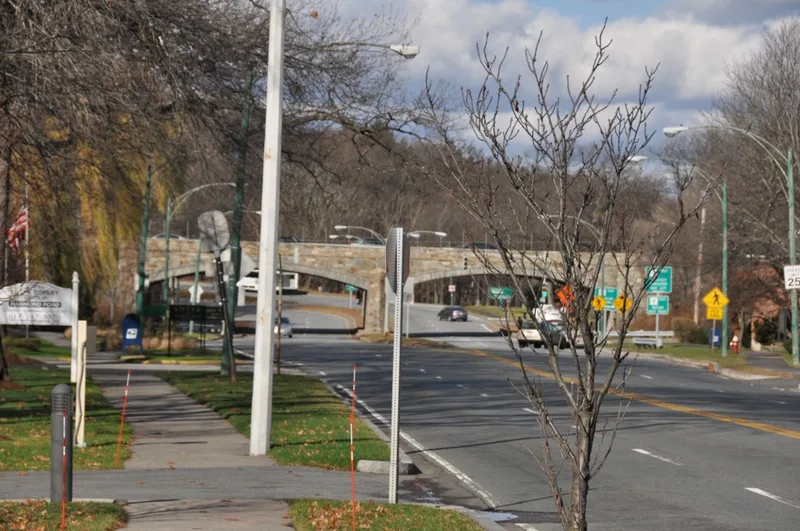
Hammond Pond Parkway is a 1.75-mile, four-lane asphalt parkway linking Beacon Street in Newton with a rotary at Horace James Memorial Circle in Brookline. Planned by the Olmsted firm for the Metropolitan Parks Commission, it follows the natural contours of the land and passes wooded parkland of the Hammond Pond Reservation before entering suburban neighborhoods. Land takings began in 1914, a preliminary study followed in 1928, and construction was finished in 1932 at a cost of $216,280. The route connected Newton and Brookline residents with the southern reservations and, together with West Roxbury Parkway, with the Arnold Arboretum, Franklin Park and Jamaica Pond. Contributing features include a cast-concrete railroad bridge, the granite double-arch Boylston Street Overpass, the Beacon Street miters and the 50-foot rotary. Later changes, such as 1930s planting and WPA walks and a 1970s land transfer for the Chestnut Hill Mall, left its integrity largely intact. It was recognized for community planning, engineering, landscape architecture and transportation.
Significance in brief: The nomination argues it is an intact example of a connecting parkway designed for the Metropolitan Parks Commission by Olmsted, Olmsted and Eliot and its successor, Olmsted Brothers. It linked Newton and Brookline residents to southern reservations and, with West Roxbury Parkway, to the Arnold Arboretum, Franklin Park and Jamaica Pond. It is significant under Criteria A and C at the local level.
Machine-generated summary. This summary was generated by a language model from the official nomination document and has not been reviewed line by line by an editor. It may contain errors. Check the source document before relying on any detail. Source: nomination document (PDF) · National Archives catalog entry. NRHP reference 04000250, listed March 18, 2004. Summary generated October 2026 (model claude-sonnet-5-5, prompt v1.0-2026-10-29, confidence high).
Key facts
| Address | Hammond Pond Parkway, Brookline |
|---|---|
| County | Norfolk County |
| Listed | March 18, 2004 |
| Reference number | 04000250 |
| Resource type | District |
| Period of significance | 1913-1956 |
| Architect / builder | Charles Eliot; Olmsted Brothers (M. McDonough Company won the construction bid) |
| Criteria |
|
| Areas of significance | Community Planning and Development, Conservation, Engineering, Landscape Architecture, Transportation |
| Level of significance | State |
| Status (as stated in the nomination) | Heavily traveled parkway administered by the Massachusetts Department of Conservation and Recreation, Division of Urban Parks and Recreation; still in road and parkland use. |
| Acreage | 14 |
| Coordinates | 42.31432, -71.16869 (NPS GIS) |
What listing means for this property
This is a historic district. Buildings within its boundary are either contributing (they add to the district's significance) or non-contributing. Owners of contributing income-producing buildings can claim the 20% federal rehabilitation tax credit; homeowners should look at state credits. National Register districts impose no design review by themselves; a local historic district ordinance, if one exists, does (the difference explained).
General information, not legal or tax advice. Rules change; confirm with your State Historic Preservation Office or a qualified adviser.
Sources and further reading
- National Park Service, National Register of Historic Places database (snapshot May 2026), reference 04000250.
- Nomination form (PDF, National Archives) — catalog entry
- Wikipedia article (used for cross-checking only; text not reproduced here)
- Wikidata Q5645856
- This listing as JSON
Last updated October 2026. Found an error? See the editorial policy for how to report it.