Wright Cemetery

Why it's listed
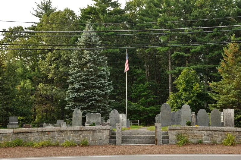
Wright Cemetery is a small, flat, grass-covered burial ground on the north side of Groton Road in Westford, Massachusetts. Its earliest marked death dates to 1819, and in 1836 the town granted Bela Wright and neighbors the privilege of keeping a burying ground there. It was privately owned by the Wright family until the 20th century, when it passed to the town. About 150 historic burials lie on roughly half an acre, among them farmers, mill workers and veterans of the Revolutionary War, the War of 1812 and World War II. Slate, marble and granite markers show changing gravestone styles, from urn-and-willow designs to a ten-foot granite obelisk. Several stones were carved by Lowell-area carvers, most often B. Day. Granite posts with wood rails and a fieldstone wall enclose the grounds. Regular repairs have changed little, and burials continue today.
Significance in brief: The nomination argues it is significant under Criterion A for its association with community events such as Revolutionary War and War of 1812 service and the establishment of family burial grounds in the early 19th century. Under Criterion C it is significant as a burial ground with gravestone carving typical of the period, including slate, marble and granite markers by Lowell-area carvers. It retains much of its historic appearance.
Machine-generated summary. This summary was generated by a language model from the official nomination document and has not been reviewed line by line by an editor. It may contain errors. Check the source document before relying on any detail. Source: nomination document (PDF) · National Archives catalog entry. NRHP reference 05001372, listed December 6, 2005. Summary generated October 2026 (model claude-sonnet-5-5, prompt v1.0-2026-10-29, confidence high).
Key facts
| Address | Groton Rd., Westford |
|---|---|
| County | Middlesex County |
| Listed | December 6, 2005 |
| Reference number | 05001372 |
| Resource type | Site |
| Period of significance | 1819-1955 |
| Architect / builder | B. Day (carver), T. Warren, D. Nichols, A. Sawtell, Andrews & Wheeler |
| Criteria |
|
| Areas of significance | Art, Community Planning and Development, Social History |
| Level of significance | Local |
| Status (as stated in the nomination) | Burials are ongoing and the cemetery has been in continuous use; most stones are in good to excellent condition, though some slate markers are eroded. |
| Acreage | 0.9 |
| Coordinates | 42.60897, -71.46696 (NPS GIS) |
What listing means for this property
Sites (archaeological sites, battlefields, landscapes) are often listed with a restricted address to protect them from looting or disturbance. Listing is honorary for private owners; federal undertakings on or near the site go through Section 106 review, and state laws may protect burials and artefacts regardless of listing.
General information, not legal or tax advice. Rules change; confirm with your State Historic Preservation Office or a qualified adviser.
Sources and further reading
- National Park Service, National Register of Historic Places database (snapshot May 2026), reference 05001372.
- Nomination form (PDF, National Archives) — catalog entry
- Wikipedia article (used for cross-checking only; text not reproduced here)
- Wikidata Q8038192
- This listing as JSON
Last updated October 2026. Found an error? See the editorial policy for how to report it.