Powder House Park
Also known as: Nathan Tufts Park

Why it's listed
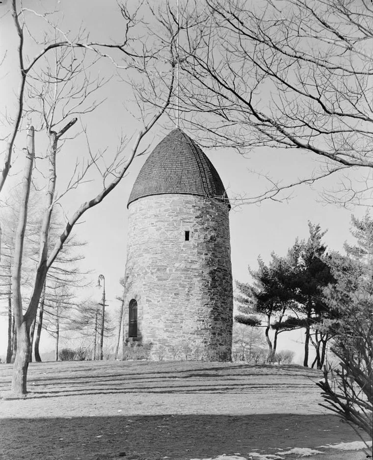
Powder House Park in Somerville, Massachusetts, covers about five acres around a former quarry with roughly 100 feet of elevation change. Its central feature is a cylindrical bluestone tower with two-foot-thick walls, built between 1704 and 1720 as a mill and quarried from the adjoining ground. In 1747 the mill was sold to the Province of Massachusetts for use as a powder house. On September 1, 1774, General Gage led a raid that removed 250 half-barrels of the colony's powder, and the building later served as a magazine for revolutionary forces. The Tufts family acquired it in 1822, and in 1890 the heirs of Nathan Tufts deeded it to the city, which created Nathan Tufts Park. The park also contains a stone Fieldhouse of 1935, built by the Work Project Administration with a small round tower and a knotty pine main room. Walkways, benches, mature trees and two tot lots complete the park.
Significance in brief: The park owes its significance mainly to the Powder House, built as a mill and later sold to the Province of Massachusetts as a powder magazine. It was the target of General Gage's raid of September 1, 1774. The Fieldhouse is significant as a Work Project Administration product built for the citizens of Somerville.
Machine-generated summary. This summary was generated by a language model from the official nomination document and has not been reviewed line by line by an editor. It may contain errors. Check the source document before relying on any detail. Source: nomination document (PDF) · National Archives catalog entry. NRHP reference 75000287, listed April 21, 1975. Summary generated October 2026 (model claude-sonnet-5-5, prompt v1.0-2026-10-29, confidence medium).
Key facts
| Address | Powder House Circle, Somerville |
|---|---|
| County | Middlesex County |
| Listed | April 21, 1975 |
| Reference number | 75000287 |
| Resource type | District |
| Architect / builder | Work Project Administration (Fieldhouse) |
| Areas of significance | Military, Architecture |
| Level of significance | State |
| Status (as stated in the nomination) | Public park owned by the City of Somerville, occupied, in fair condition, with playground areas and landscaped walkways. |
| Acreage | 5 |
| Coordinates | 42.40040, -71.11662 (NPS GIS) |
What listing means for this property
This is a historic district. Buildings within its boundary are either contributing (they add to the district's significance) or non-contributing. Owners of contributing income-producing buildings can claim the 20% federal rehabilitation tax credit; homeowners should look at state credits. National Register districts impose no design review by themselves; a local historic district ordinance, if one exists, does (the difference explained).
General information, not legal or tax advice. Rules change; confirm with your State Historic Preservation Office or a qualified adviser.
Sources and further reading
- National Park Service, National Register of Historic Places database (snapshot May 2026), reference 75000287.
- Nomination form (PDF, National Archives) — catalog entry
- Wikipedia article (used for cross-checking only; text not reproduced here)
- Wikidata Q7235979
- This listing as JSON
Last updated October 2026. Found an error? See the editorial policy for how to report it.