Orvis Road Historic District

Why it's listed
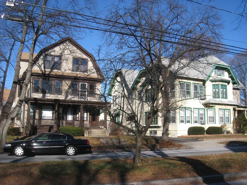
Orvis Road in Arlington, Massachusetts, is a planned residential street of twenty-six single- and two-family houses built between 1918 and 1930. The homes face a landscaped grassy median planted with trees and flowering shrubs, the only such residential thoroughfare in the town. Houses combine Craftsman and Colonial Revival features, including bungalows and stucco two-family buildings, and most keep their original porches, entryways and garages. The street was platted in 1918 on land that had been part of John P. Squire's market garden farm, at a time when farmers were increasingly selling land to developers. Close to Massachusetts Avenue, a major route to Boston, it suited middle-income commuters using public transit or their own cars, and the ca. 1920 garages reflect the importance of the automobile. The neighborhood was recognized for its architectural quality, its cohesion, and its role in Arlington's suburban growth in the early twentieth century.
Significance in brief: The district is significant for its well-preserved, finely detailed single- and two-family dwellings and for its link to Arlington's early 20th-century suburban development. It was one of the most successful developments on former market garden land, with green spaces unusual for the town's middle-class neighborhoods. It retains integrity and is described as a singularly cohesive neighborhood.
Machine-generated summary. This summary was generated by a language model from the official nomination document and has not been reviewed line by line by an editor. It may contain errors. Check the source document before relying on any detail. Source: nomination document (PDF) · National Archives catalog entry. NRHP reference 85002677, listed September 27, 1985. Summary generated October 2026 (model claude-sonnet-5-5, prompt v1.0-2026-10-29, confidence medium).
Key facts
| Address | Roughly bounded by Massachsetts Ave., Freeman, Randolph and Newcomb Sts. on Orvis Rd., Arlington |
|---|---|
| County | Middlesex County |
| Listed | September 27, 1985 |
| Reference number | 85002677 |
| Resource type | District |
| Period of significance | 1918-1930 |
| Architectural style | Craftsman, Colonial Revival, and Craftsman/Bungalow |
| Criteria |
|
| Areas of significance | Community Planning and Development, Architecture |
| Level of significance | Local |
| Status (as stated in the nomination) | Described as having no intrusions; most houses retain original porches, entryways and garages. |
| Acreage | 4.5 |
| Coordinates | 42.40594, -71.14537 (NPS GIS) |
What listing means for this property
This is a historic district. Buildings within its boundary are either contributing (they add to the district's significance) or non-contributing. Owners of contributing income-producing buildings can claim the 20% federal rehabilitation tax credit; homeowners should look at state credits. National Register districts impose no design review by themselves; a local historic district ordinance, if one exists, does (the difference explained).
General information, not legal or tax advice. Rules change; confirm with your State Historic Preservation Office or a qualified adviser.
Sources and further reading
- National Park Service, National Register of Historic Places database (snapshot May 2026), reference 85002677.
- Nomination form (PDF, National Archives) — catalog entry
- Wikipedia article (used for cross-checking only; text not reproduced here)
- Wikidata Q7105267
- This listing as JSON
Last updated October 2026. Found an error? See the editorial policy for how to report it.