West Chesterfield Historic District

Why it's listed
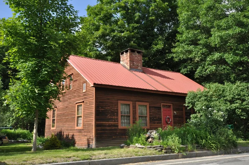
West Chesterfield is a village district in the Westfield River valley in the hill country of western Massachusetts, about three miles northwest of Chesterfield Center and roughly 700 feet lower in elevation. The district contains 45 contributing resources, mainly 19th-century houses, barns and mill-related sites, plus the 1948 West Chesterfield Bridge, a cemetery and the river itself. Federal-style Capes such as the Bryant and Robinson houses sit alongside Greek Revival, Italianate, Queen Anne and Colonial Revival buildings. The village's importance rests on its role as a small industrial and transportation node. A turnpike toll gate and later stagecoach traffic passed through, and men with mechanical skills ran sawmills, tanneries, foundries and woodworking shops on the river and West Branch. Mill owners tried canals, water wheels, steam and electrical power to keep a steady source of energy. Buildings like the Thayer Brothers General Store and the Rhoades and Porter Plane Handle Shop reflect that working past.
Significance in brief: The visible portion of the nomination describes a village that grew around waterpower and small-scale industry along the Westfield River and its West Branch. Its buildings run from Federal Capes to Greek Revival, Italianate, Queen Anne and Colonial Revival styles. The significance statement covers settlement, turnpike and stagecoach transport, and an Early Industrial period (1830-1870) of mills, shops and a general store. The truncated text does not state the criteria or period of significance.
Machine-generated summary. This summary was generated by a language model from the official nomination document and has not been reviewed line by line by an editor. It may contain errors. Check the source document before relying on any detail. Source: nomination document (PDF) · National Archives catalog entry. NRHP reference 08000950, listed September 25, 2008. Summary generated October 2026 (model claude-sonnet-5-5, prompt v1.0-2026-10-29, confidence medium).
Key facts
| Address | 1-70 Ireland St. and unnumbered lots, 620-669 Main Rd., section of Cummington Rd., Chesterfield |
|---|---|
| County | Hampshire County |
| Listed | September 25, 2008 |
| Reference number | 08000950 |
| Resource type | District |
| Architectural style | Early Republic: Federal; Mid 19th C.: Greek Revival, Italianate; Late Victorian: Queen Anne; Late 19th & 20th Century Revival: Colonial Revival |
| Areas of significance | Architecture, Historic - Non-Aboriginal, Community Planning and Development, Industry |
| Level of significance | Local |
| Status (as stated in the nomination) | Current functions include single dwellings, a post office, a cemetery and river landscape. The Thayer Brothers General Store basement is described as in process of restoration. |
| Coordinates | 42.40267, -72.87781 (NPS GIS) |
What listing means for this property
This is a historic district. Buildings within its boundary are either contributing (they add to the district's significance) or non-contributing. Owners of contributing income-producing buildings can claim the 20% federal rehabilitation tax credit; homeowners should look at state credits. National Register districts impose no design review by themselves; a local historic district ordinance, if one exists, does (the difference explained).
General information, not legal or tax advice. Rules change; confirm with your State Historic Preservation Office or a qualified adviser.
Sources and further reading
- National Park Service, National Register of Historic Places database (snapshot May 2026), reference 08000950.
- Nomination form (PDF, National Archives) — catalog entry
- Wikipedia article (used for cross-checking only; text not reproduced here)
- Wikidata Q16903099
- This listing as JSON
Last updated October 2026. Found an error? See the editorial policy for how to report it.