North Chester Historic District

Why it's listed
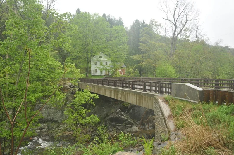
North Chester is a small village district in Chester, Massachusetts, set in a valley where the Middle Branch of the Westfield River runs northwest to southeast. Houses, barns, a chapel, a former schoolhouse, a cemetery with about 46 headstones, stone walls and an 1887 iron truss bridge are spread widely through a rural landscape of fields and woodland. Among the notable buildings are the Cushman Tavern of about 1773, the Greek Revival James Elder and John Stevens houses, the Gothic Revival Howe House of about 1860, and the 1909 chapel. The village grew around mills established by the Stevens family, later run by the Plunkett brothers, and around Elbridge Howe's bedstead factory. East River Road served as a main route between Pittsfield and Springfield, which supported an inn. Remains of mill dams and factory foundations give the area high archaeological potential. Little construction since 1909-1910 has preserved its 19th-century character.
Significance in brief: The district keeps its 19th-century rural village appearance, with few changes since 1909-1910. It documents the area's settlement, its mills and small industries, and the travel along East River Road. Its buildings show how traditional forms persisted in modest Georgian, Federal, Greek Revival, Gothic Revival and Colonial Revival styles, and it has high archaeological potential.
Machine-generated summary. This summary was generated by a language model from the official nomination document and has not been reviewed line by line by an editor. It may contain errors. Check the source document before relying on any detail. Source: nomination document (PDF) · National Archives catalog entry. NRHP reference 96001465, listed December 6, 1996. Summary generated October 2026 (model claude-sonnet-5-5, prompt v1.0-2026-10-29, confidence medium).
Key facts
| Address | Rougly bounded by E. River, Smith, and N. Chester Rds., Chester |
|---|---|
| County | Hampshire County |
| Listed | December 6, 1996 |
| Reference number | 96001465 |
| Resource type | District |
| Architect / builder | Iron bridge designed by Richard Hawkins of Springfield (1887); stone walls built by Amos Cone |
| Architectural style | Colonial/Georgian; Mid-19th Century/Greek Revival/Gothic Revival; 20th Century Revival/Colonial Revival |
| Areas of significance | Industry, Community Planning and Development, Agriculture |
| Level of significance | Local |
| Status (as stated in the nomination) | Properties in the district are described as in good condition. The district retains its 19th-century hilltown village appearance. |
| Acreage | 282.5 |
| Coordinates | 42.32645, -72.93493 (NPS GIS) |
What listing means for this property
This is a historic district. Buildings within its boundary are either contributing (they add to the district's significance) or non-contributing. Owners of contributing income-producing buildings can claim the 20% federal rehabilitation tax credit; homeowners should look at state credits. National Register districts impose no design review by themselves; a local historic district ordinance, if one exists, does (the difference explained).
General information, not legal or tax advice. Rules change; confirm with your State Historic Preservation Office or a qualified adviser.
Sources and further reading
- National Park Service, National Register of Historic Places database (snapshot May 2026), reference 96001465.
- Nomination form (PDF, National Archives) — catalog entry
- Wikipedia article (used for cross-checking only; text not reproduced here)
- Wikidata Q7054797
- This listing as JSON
Last updated October 2026. Found an error? See the editorial policy for how to report it.