Walnut Grove Cemetery
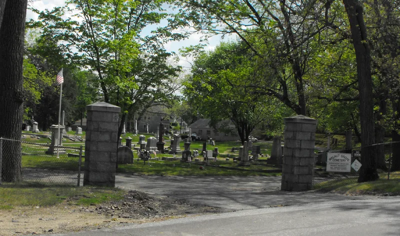

Why it's listed
Walnut Grove Cemetery covers 15 acres along Grove Street, just west of Methuen's present town center. An association of individuals laid it out in 1853, using the winding pathways and shade trees favored by romantic designers of the period. More than 1,500 stones survive, with death dates from 1853 to 1978. They are made of slate, marble and granite and take forms such as columns, obelisks and tables. Many are grouped in family plots edged with stone coping or cast iron fences, and several tombs draw on classical and medieval models. In the early twentieth century the Tenny family donated land to expand the older northern section. In 1927 they built a red brick chapel as a memorial to Mr. and Mrs. Charles H. Tenny. The cemetery is valued as an example of mid-19th century romantic planning, for its link to Methuen's rapid growth in that era, and for its connection to the Tenny family. It remains in generally good condition.
Significance in brief: The nomination presents the cemetery as an example of mid-19th century romantic planning, with winding paths and shade trees. It is also tied to Methuen's rapid mid-19th century development and to the Tenny family, who donated land and built the chapel. It is said to meet criteria A, B and C.
Machine-generated summary. This summary was generated by a language model from the official nomination document and has not been reviewed line by line by an editor. It may contain errors. Check the source document before relying on any detail. Source: nomination document (PDF) · National Archives catalog entry. NRHP reference 84002444, listed January 20, 1984. Summary generated October 2026 (model claude-sonnet-5-5, prompt v1.0-2026-10-29, confidence medium).
Key facts
| Address | Grove and Railroads Sts., Methuen |
|---|---|
| County | Essex County |
| Listed | January 20, 1984 |
| Reference number | 84002444 |
| Resource type | Site |
| Architectural style | Mid-19th century romantic cemetery design |
| Criteria |
|
| Areas of significance | Community Planning and Development, Landscape Architecture, Architecture |
| Level of significance | Local |
| Status (as stated in the nomination) | Generally good condition, with few broken or overturned stones. |
| Acreage | 15 |
| Coordinates | 42.72302, -71.19016 (NPS GIS) |
What listing means for this property
Sites (archaeological sites, battlefields, landscapes) are often listed with a restricted address to protect them from looting or disturbance. Listing is honorary for private owners; federal undertakings on or near the site go through Section 106 review, and state laws may protect burials and artefacts regardless of listing.
General information, not legal or tax advice. Rules change; confirm with your State Historic Preservation Office or a qualified adviser.
Sources and further reading
- National Park Service, National Register of Historic Places database (snapshot May 2026), reference 84002444.
- Nomination form (PDF, National Archives) — catalog entry
- Wikipedia article (used for cross-checking only; text not reproduced here)
- Wikidata Q14715971
- This listing as JSON
Last updated October 2026. Found an error? See the editorial policy for how to report it.