Newburyport Harbor Front Range Light

Why it's listed
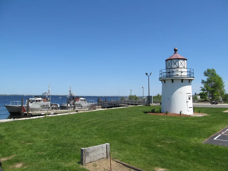
Newburyport's Harbor Front Range Light is a 35-foot tower built in 1873 to guide vessels into the harbor. Its lower 15 feet are steel plate lined with brick, and the upper 20 feet form a hexagonal wood frame covered in white shingles. Originally on Bayley's Wharf, it worked with a rear tower a few hundred feet away on Water Street to help mariners avoid the dangerous reef known as Goose Rocks. The Coast Guard moved it in 1964 to its present spot within the Merrimac River Coast Guard Station grounds. The roof was raised before 1957, when the light was changed from a range light to a channel light, though the original roof and lantern room remain intact. Today it is used for storage and still serves as a daymark. It was listed as part of the pair of Newburyport range lights, one of only three sets in Massachusetts, for its role in navigation aids and its design and materials.
Significance in brief: The front light and its rear companion are one of only three sets of range lights in Massachusetts and are described as the best example of a range light in the state. The form cites integrity of location, design, materials and workmanship, and associations with the development of aids to navigation. It argues significance despite the tower having been moved and altered.
Machine-generated summary. This summary was generated by a language model from the official nomination document and has not been reviewed line by line by an editor. It may contain errors. Check the source document before relying on any detail. Source: nomination document (PDF) · National Archives catalog entry. NRHP reference 87001486, listed June 15, 1987. Summary generated October 2026 (model claude-sonnet-5-5, prompt v1.0-2026-10-29, confidence medium).
Key facts
| Address | Merrimac River Coast Guard Station, Newburyport |
|---|---|
| County | Essex County |
| Listed | June 15, 1987 |
| Reference number | 87001486 |
| Resource type | Structure |
| Criteria |
|
| Areas of significance | Engineering, Transportation, Architecture, Maritime History |
| Level of significance | State |
| Status (as stated in the nomination) | Unmanned and inactive as a light; used only for storage at an active Coast Guard station, though it appears well tended and is still used as a daymark by navigators. |
| Acreage | 0.9 |
| Coordinates | 42.79848, -70.80928 (NPS GIS) |
What listing means for this property
National Register listing is honorary: it recognises significance and does not restrict what a private owner may do without federal money or permits. It unlocks the 20% federal rehabilitation tax credit for income-producing buildings, state credits in many states, and Section 106 review when federal agencies are involved. See what listing means in practice.
General information, not legal or tax advice. Rules change; confirm with your State Historic Preservation Office or a qualified adviser.
Sources and further reading
- National Park Service, National Register of Historic Places database (snapshot May 2026), reference 87001486.
- Nomination form (PDF, National Archives) — catalog entry
- Wikipedia article (used for cross-checking only; text not reproduced here)
- Wikidata Q14715767
- This listing as JSON
Last updated October 2026. Found an error? See the editorial policy for how to report it.