New Hampshire, The
Also known as: Alabama; Granite State
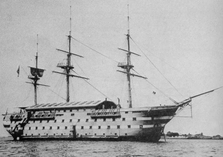

Why it's listed
Off the coast of Manchester, Massachusetts, the remains of the New Hampshire lie on a sandy bottom in up to thirty-five feet of water beside Graves Island. Begun at the Portsmouth Navy Yard in 1819 as the Alabama, she was one of nine ships-of-the-line carrying at least 74 guns that Congress authorized in 1816. Steam and iron made her obsolete before she saw battle, and she served instead as a stores and depot ship during the Civil War, a receiving ship, a training ship, and a flagship for an apprentice training squadron. She was renamed New Hampshire in 1863 and Granite State in 1904. She burned and sank at her pier in the Hudson River in 1921, was refloated, and sank again under tow after the towline parted. Today about six ribs protrude from the sand, and copper and brass fittings survive. The wreck is regarded as one of the few visible in New England waters.
Significance in brief: The nomination argues the ship is significant as one of the last wooden battleships built before steam and speed took over, and as one of nine ships-of-the-line authorized by Congress in 1816. The wreckage is also noted as one of the few visible wrecks in New England waters.
Machine-generated summary. This summary was generated by a language model from the official nomination document and has not been reviewed line by line by an editor. It may contain errors. Check the source document before relying on any detail. Source: nomination document (PDF) · National Archives catalog entry. NRHP reference 76000261, listed October 29, 1976. Summary generated October 2026 (model claude-sonnet-5-5, prompt v1.0-2026-10-29, confidence high).
Key facts
| Address | SE of Manchester off Graves Island, Manchester |
|---|---|
| County | Essex County |
| Listed | October 29, 1976 |
| Reference number | 76000261 |
| Resource type | Site |
| Period of significance | 1819 |
| Architect / builder | attributed to William Doughty |
| Areas of significance | Military, Engineering |
| Level of significance | State |
| Status (as stated in the nomination) | Wreckage lies underwater in various pieces, with about six ribs protruding from the sandy bottom; copper and brass fittings and copper sheathing remain. Condition is marked altered and moved. |
| Acreage | 1 |
| Coordinates | 42.57074, -70.74505 (NPS GIS) |
What listing means for this property
Sites (archaeological sites, battlefields, landscapes) are often listed with a restricted address to protect them from looting or disturbance. Listing is honorary for private owners; federal undertakings on or near the site go through Section 106 review, and state laws may protect burials and artefacts regardless of listing.
General information, not legal or tax advice. Rules change; confirm with your State Historic Preservation Office or a qualified adviser.
Sources and further reading
- National Park Service, National Register of Historic Places database (snapshot May 2026), reference 76000261.
- Nomination form (PDF, National Archives) — catalog entry
- Wikipedia article (used for cross-checking only; text not reproduced here)
- Wikidata Q11653806
- This listing as JSON
Last updated October 2026. Found an error? See the editorial policy for how to report it.