Westport Point Historic District

Why it's listed
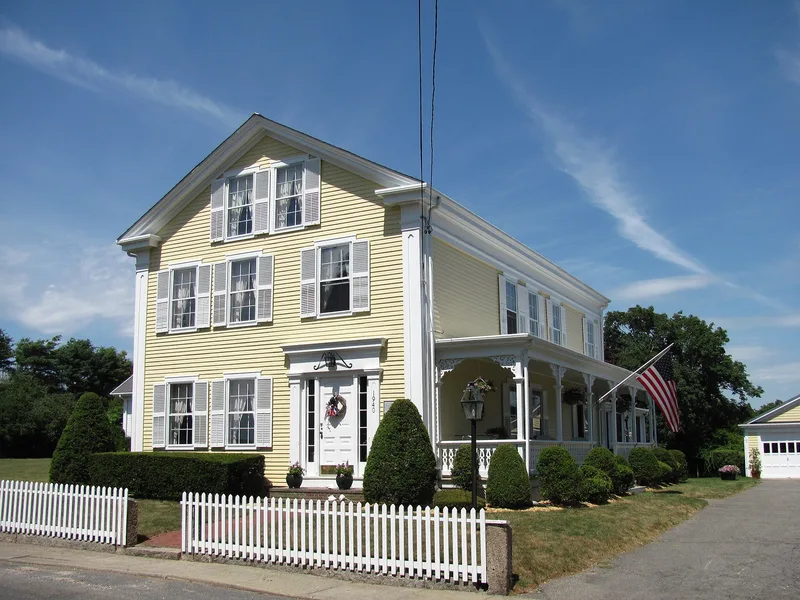
Westport Point Historic District covers roughly 86 acres at the southern tip of a peninsula where the East and West Branches of the Westport River meet. Stretching about a mile along Main Road, with two narrow side lanes, it holds 233 contributing resources, mostly modest wood-frame houses built between about 1770 and 1940. The southern end is largely Georgian and Federal, while the northern portion is mostly Greek Revival, with later Victorian houses and summer cottages filling in between. Local carpenter-architects built many of the houses as vernacular versions of high styles. The village grew from an 18th century fishing and whaling port into a modest summer resort after the Civil War. Houses sit close to the street, stone walls and fences line the road, and commercial fishing boats still work from the wharves. Few modern buildings intrude, and the district is recognized for its architecture and its record of maritime and resort history.
Significance in brief: The district embodies a coastal village that first lived off fishing, whaling and related maritime trades and later became a modest summer resort. Its buildings reflect each phase of that development, from Georgian and Federal houses to Greek Revival, Victorian and summer cottages. The dense 18th to early 20th century fabric remains largely intact with few modern intrusions.
Machine-generated summary. This summary was generated by a language model from the official nomination document and has not been reviewed line by line by an editor. It may contain errors. Check the source document before relying on any detail. Source: nomination document (PDF) · National Archives catalog entry. NRHP reference 92000815, listed June 25, 1992. Summary generated October 2026 (model claude-sonnet-5-5, prompt v1.0-2026-10-29, confidence medium).
Key facts
| Address | Roughly, Main St. from Charles St. to W. Branch, Westport R., including Cape Bial and Valentine Lns., Westport |
|---|---|
| County | Bristol County |
| Listed | June 25, 1992 |
| Reference number | 92000815 |
| Resource type | District |
| Period of significance | Ca. 1770 - 1940 |
| Architectural style | Georgian, Federal, Greek Revival, Gothic Revival, Second Empire, Colonial Revival, Bungalow/Craftsman |
| Criteria |
|
| Areas of significance | Industry, Commerce, Architecture |
| Level of significance | Local |
| Status (as stated in the nomination) | Most buildings are in excellent condition and little altered; most remain residences, with a few stores, a post office, a church and a cemetery. The area has been a local historic district for about twenty years. |
| Acreage | 86 |
| Coordinates | 41.52311, -71.07445 (NPS GIS) |
What listing means for this property
This is a historic district. Buildings within its boundary are either contributing (they add to the district's significance) or non-contributing. Owners of contributing income-producing buildings can claim the 20% federal rehabilitation tax credit; homeowners should look at state credits. National Register districts impose no design review by themselves; a local historic district ordinance, if one exists, does (the difference explained).
General information, not legal or tax advice. Rules change; confirm with your State Historic Preservation Office or a qualified adviser.
Sources and further reading
- National Park Service, National Register of Historic Places database (snapshot May 2026), reference 92000815.
- Nomination form (PDF, National Archives) — catalog entry
- Wikipedia article (used for cross-checking only; text not reproduced here)
- Wikidata Q7989604
- This listing as JSON
Last updated October 2026. Found an error? See the editorial policy for how to report it.