Hortonville Historic District

Why it's listed
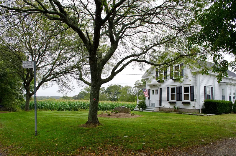
Hortonville is a village strung along Locust Street in northern Swansea, close to the Rehoboth line. Its roughly 122 acres hold farmhouses, village cottages and open pasture, with Cole's River forming part of the southern edge. Settlement began in the mid-18th century when the Hale, Martin and Eddy families farmed the western end. The oldest building is the Melatiah Martin House of 1736. In the early 19th century the eastern end near the river became an industrial center. A cotton mill opened in 1806 and burned in 1836, and grist mills also operated there. The 1830s brought a school, chapel and meeting hall, and the 1838 schoolhouse is the oldest surviving one in town. By the late 19th century the village was self-sufficient, with a store and post office. After about 1900 development nearly stopped and the area returned to farming and housing. Baker Farm remains a major agricultural presence. The district was listed for its local historical and architectural value.
Significance in brief: The district shows how scattered 18th-century farmsteads grew into a nucleated village by the late 19th century. It was also a primary industrial location in Swansea, with cotton and grist mills, although only the houses tied to that industry survive. It retains a range of styles from Georgian to Colonial Revival in an open agricultural setting.
Machine-generated summary. This summary was generated by a language model from the official nomination document and has not been reviewed line by line by an editor. It may contain errors. Check the source document before relying on any detail. Source: nomination document (PDF) · National Archives catalog entry. NRHP reference 90000051, listed February 16, 1990. Summary generated October 2026 (model claude-sonnet-5-5, prompt v1.0-2026-10-29, confidence high).
Key facts
| Address | Locust St. from Oak St. to Hortonville Rd., Swansea |
|---|---|
| County | Bristol County |
| Listed | February 16, 1990 |
| Reference number | 90000051 |
| Resource type | District |
| Architectural style | Georgian, Federal, Greek Revival, Italianate, Queen Anne and Colonial Revival |
| Criteria |
|
| Areas of significance | Community Planning and Development, Agriculture, Exploration/Settlement, Architecture |
| Level of significance | Local |
| Status (as stated in the nomination) | General condition stated as good; present uses are residential and agricultural. The district has 45 buildings, two sites and two structures, of which 23 buildings, two sites and two structures are contributing. |
| Acreage | 122 |
| Coordinates | 41.77419, -71.20958 (NPS GIS) |
What listing means for this property
This is a historic district. Buildings within its boundary are either contributing (they add to the district's significance) or non-contributing. Owners of contributing income-producing buildings can claim the 20% federal rehabilitation tax credit; homeowners should look at state credits. National Register districts impose no design review by themselves; a local historic district ordinance, if one exists, does (the difference explained).
General information, not legal or tax advice. Rules change; confirm with your State Historic Preservation Office or a qualified adviser.
Sources and further reading
- National Park Service, National Register of Historic Places database (snapshot May 2026), reference 90000051.
- Nomination form (PDF, National Archives) — catalog entry
- Wikipedia article (used for cross-checking only; text not reproduced here)
- Wikidata Q5906987
- This listing as JSON
Last updated October 2026. Found an error? See the editorial policy for how to report it.