East Freetown Historic District

Why it's listed
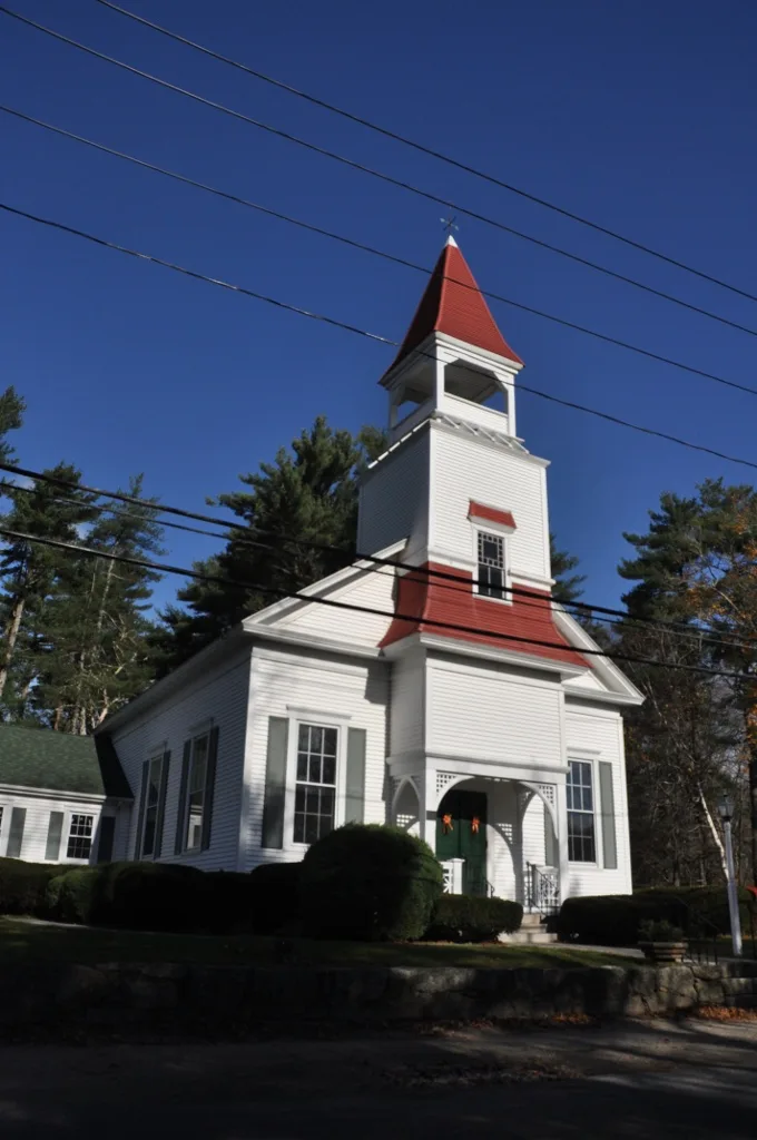
East Freetown is a small industrial village in the eastern part of Freetown, Massachusetts, arranged around Fall Brook and its mill pond. Settlement began in 1727 when Philip Rounsevell established his homestead, and the district's resources date from that year through 1949. Most houses are modest 1 1/2 story Cape Cod cottages on granite foundations, with later Greek Revival, Gothic Revival, Italianate and Queen Anne examples. A tavern altered in the Queen Anne style, a Congregational church built in 1888, a memorial library opened in 1947 and a working saw mill add to the village. Water-powered industry shaped the place, and remains include dams, mill foundations, the half-dome granite remnant of an iron furnace and arched granite bridges. A small granite Mile Square Marker from about 1727 is the oldest object. Together, the 104 resources show how a rural mill community developed, with space around each building and winding roads.
Significance in brief: The district is significant at the local level for the quality of its architecture, which shows the community's development from the early 18th century to just after World War II. It keeps several Colonial-period Cape Cod houses, an 1818 granite furnace remnant, stone arched bridges and the 1727 Mile Square Marker. Its industrial sites and compact village layout reveal its growth over time.
Machine-generated summary. This summary was generated by a language model from the official nomination document and has not been reviewed line by line by an editor. It may contain errors. Check the source document before relying on any detail. Source: nomination document (PDF) · National Archives catalog entry. NRHP reference 99001115, listed September 9, 1999. Summary generated October 2026 (model claude-sonnet-5-5, prompt v1.0-2026-10-29, confidence medium).
Key facts
| Address | Roughly along Howland, Gurney, Washburn County Rds., Freetown |
|---|---|
| County | Bristol County |
| Listed | September 9, 1999 |
| Reference number | 99001115 |
| Resource type | District |
| Period of significance | 1727-1949 |
| Architect / builder | Abial S. Ashley (builder) and Clothier Franklin Edminister (architect) for the Christian Congregational Church, 1888 |
| Architectural style | Colonial, Georgian, Late Victorian, Queen Anne, Other: Cape Cod |
| Areas of significance | Architecture, Community Planning and Development, Industry |
| Level of significance | Local |
| Status (as stated in the nomination) | Eighty of 104 resources contribute; the Gurney Saw Mill, library, church and houses remain in use, while the Furnace/Washburn Store was demolished about 1949 and the Washburn House about 1957. |
| Acreage | 94 |
| Coordinates | 41.77275, -70.96176 (NPS GIS) |
What listing means for this property
This is a historic district. Buildings within its boundary are either contributing (they add to the district's significance) or non-contributing. Owners of contributing income-producing buildings can claim the 20% federal rehabilitation tax credit; homeowners should look at state credits. National Register districts impose no design review by themselves; a local historic district ordinance, if one exists, does (the difference explained).
General information, not legal or tax advice. Rules change; confirm with your State Historic Preservation Office or a qualified adviser.
Sources and further reading
- National Park Service, National Register of Historic Places database (snapshot May 2026), reference 99001115.
- Nomination form (PDF, National Archives) — catalog entry
- Wikipedia article (used for cross-checking only; text not reproduced here)
- Wikidata Q5328390
- This listing as JSON
Last updated October 2026. Found an error? See the editorial policy for how to report it.