Carpenter Bridge

Why it's listed
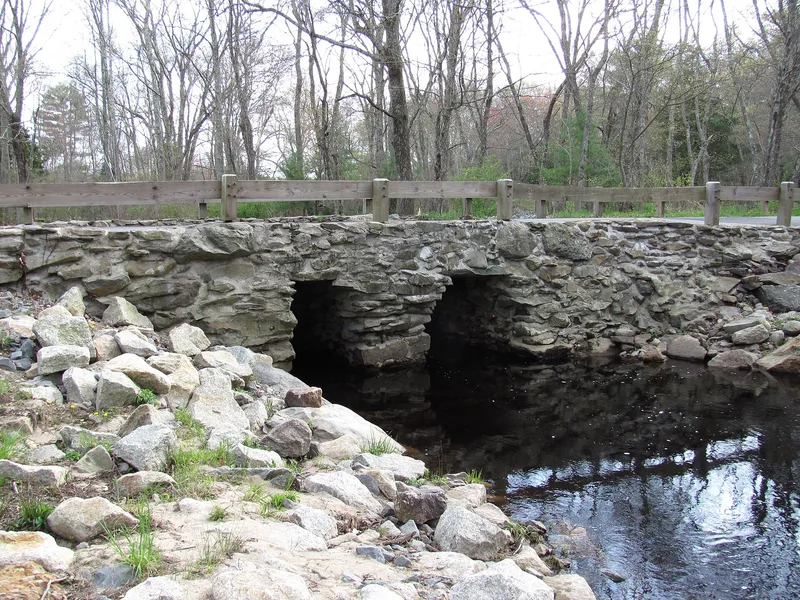
Carpenter Bridge carries Carpenter Street across the west branch of the Palmer River in a rural part of Rehoboth. Built in 1873, it is a dry-laid fieldstone structure with two abutments and a central pier flared at the top to shorten the span of the cap stones, which reach 10 feet in length. Low stone retaining walls run along the road for several yards. It replaced a double-span wooden bridge from about 1720, built when Carpenter Street, once an Indian trail, became a public road and carried sawn lumber, corn and grain. Town Meeting appropriated money for a lower-maintenance stone replacement, and road boss William Lake and three assistants finished it in two weeks for $218.15, using only local stone and locally milled timber. It is regarded as the last surviving small stone bridge of its kind in Rehoboth, since others were replaced by concrete and culverts. The town restored it in 1981.
Significance in brief: The bridge is described as the only surviving example of the small stone bridges built across Rehoboth's many streams in the 19th century; others have been replaced with concrete and culverts. It replaced a c. 1720 wooden bridge on a road that began as an Indian trail. The form checks themes of architecture, exploration/settlement, community development and transportation.
Machine-generated summary. This summary was generated by a language model from the official nomination document and has not been reviewed line by line by an editor. It may contain errors. Check the source document before relying on any detail. Source: nomination document (PDF) · National Archives catalog entry. NRHP reference 83000641, listed June 6, 1983. Summary generated October 2026 (model claude-sonnet-5-5, prompt v1.0-2026-10-29, confidence medium).
Key facts
| Address | Carpenter St., Rehoboth |
|---|---|
| County | Bristol County |
| Listed | June 6, 1983 |
| Reference number | 83000641 |
| Resource type | Structure |
| Architect / builder | William Lake, road boss, with three assistants |
| Areas of significance | Engineering |
| Level of significance | Local |
| Status (as stated in the nomination) | Restored in 1981; still in use as a bridge on a public roadway. |
| Acreage | 0.1 |
| Coordinates | 41.82805, -71.25514 (NPS GIS) |
What listing means for this property
For a publicly owned building or structure, listing mainly matters when federal funds, permits or licences are involved: projects then go through Section 106 review so effects on the property are considered. Listing also strengthens applications for preservation grants and, for leased income-producing uses, can enable the federal rehabilitation tax credit.
General information, not legal or tax advice. Rules change; confirm with your State Historic Preservation Office or a qualified adviser.
Sources and further reading
- National Park Service, National Register of Historic Places database (snapshot May 2026), reference 83000641.
- Nomination form (PDF, National Archives) — catalog entry
- Wikipedia article (used for cross-checking only; text not reproduced here)
- Wikidata Q5045704
- This listing as JSON
Last updated October 2026. Found an error? See the editorial policy for how to report it.