Old Churchyard Cemetery
Also known as: Jenks Road Cemetery, Stafford Hill Cemetery; Chs.803

Why it's listed
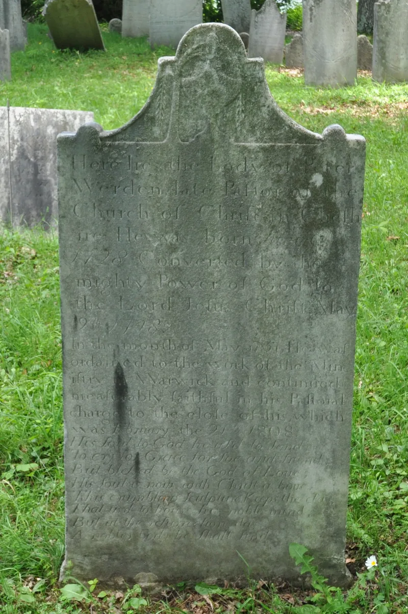
On the west slope of Stafford Hill in rural Cheshire, Massachusetts, a small walled burying ground holds the graves of the Baptist settlers of New Providence, who came from Rhode Island in the 1760s. Gravestones date from 1785 to 1848, and about 70 remain above ground, mostly white marble, with a few red sandstone and slate markers. Most are plain, though some carry willow-and-urn designs or classical details, and inscriptions record family ties, causes of death and religious sentiment. The grave of Elder Peter Werden, the first pastor, lies here. The site was neglected for years until 1913, when the Berkshire Baptist Association had stones reset, the ground graded and a stone wall with an iron gate built. The cemetery is listed for its link to the settlement of the area and the Baptist community, and for the artistry of its markers. An old church once stood beside it, and archaeological remains may survive.
Significance in brief: The cemetery is tied to New Providence, a settlement of Baptists from Rhode Island, and holds the graves of its early church founders, including pastor Elder Peter Werden. It is significant under Criterion A for Exploration and Settlement and Social History, and under Criterion C for the art of its gravestones. The 1913 rehabilitation by the Berkshire Baptist Association ends the period of significance.
Machine-generated summary. This summary was generated by a language model from the official nomination document and has not been reviewed line by line by an editor. It may contain errors. Check the source document before relying on any detail. Source: nomination document (PDF) · National Archives catalog entry. NRHP reference 12000206, listed April 16, 2012. Summary generated October 2026 (model claude-sonnet-5-5, prompt v1.0-2026-10-29, confidence medium).
Key facts
| Address | Adjacent to 918 Jenks Rd., Cheshire |
|---|---|
| County | Berkshire County |
| Listed | April 16, 2012 |
| Reference number | 12000206 |
| Resource type | Site |
| Period of significance | 1785-1913 |
| Criteria |
|
| Areas of significance | Art, Exploration/Settlement, Social History |
| Level of significance | Local |
| Status (as stated in the nomination) | Still a cemetery; about 70 headstones remain above ground, several broken or tipped, and many marble stones are badly weathered. Stones were reset and the site walled in 1913. |
| Acreage | 0.9 |
| Coordinates | 42.58294, -73.12346 (NPS GIS) |
What listing means for this property
Sites (archaeological sites, battlefields, landscapes) are often listed with a restricted address to protect them from looting or disturbance. Listing is honorary for private owners; federal undertakings on or near the site go through Section 106 review, and state laws may protect burials and artefacts regardless of listing.
General information, not legal or tax advice. Rules change; confirm with your State Historic Preservation Office or a qualified adviser.
Sources and further reading
- National Park Service, National Register of Historic Places database (snapshot May 2026), reference 12000206.
- Nomination form (PDF, National Archives) — catalog entry
- Wikipedia article (used for cross-checking only; text not reproduced here)
- Wikidata Q16896095
- This listing as JSON
Last updated October 2026. Found an error? See the editorial policy for how to report it.