Maple Street Cemetery
Also known as: Mount Vernon; Friends Burial Ground

Why it's listed
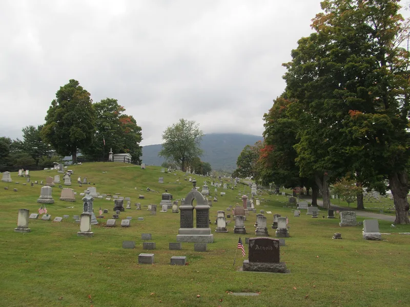
Maple Street Cemetery occupies sixteen acres on the west side of Adams, Massachusetts, beneath Mount Greylock. It began as a Quaker burial ground around 1767, with a Meeting House added in 1784, while the town created its own burial area on the eastern rise before 1800. The town joined the two areas in 1859 by buying the nine acres between them. In 1869 local civil engineer Charles F. Sayles drew the plan that still organizes the grounds, with Memorial Circle, long east-west roads, cross lanes and burial sections. Later additions include an 1864-1865 marble receiving tomb, Works Progress Administration marble curbing and walls, and the 1936 entrance gates. The cemetery holds the ca. 1900 Plunkett Mausoleum, unmarked Quaker graves, iron crosses for Polish children, and monuments to mill owners and workers. Mature sugar maples and long views of Mount Greylock and the town's mills and church spires remain.
Significance in brief: The cemetery is significant as a rare town cemetery with a known designer, civil engineer Charles F. Sayles, whose 1869 plan survives largely intact. It also preserves the Quaker burial ground and 1784 Meeting House, and a wide range of gravemarkers reflecting the town's manufacturing history. It has archaeological potential for Native American and historic-period information.
Machine-generated summary. This summary was generated by a language model from the official nomination document and has not been reviewed line by line by an editor. It may contain errors. Check the source document before relying on any detail. Source: nomination document (PDF) · National Archives catalog entry. NRHP reference 04000536, listed June 2, 2004. Summary generated October 2026 (model claude-sonnet-5-5, prompt v1.0-2026-10-29, confidence medium).
Key facts
| Address | Maple St., Adams |
|---|---|
| County | Berkshire County |
| Listed | June 2, 2004 |
| Reference number | 04000536 |
| Resource type | Site |
| Architect / builder | Charles F. Sayles (civil engineer, 1869 cemetery plan) |
| Areas of significance | Art, Architecture, Community Planning and Development, Landscape Architecture, Religion, Social History |
| Level of significance | Local |
| Status (as stated in the nomination) | Still an active cemetery, with burials as late as 2001; the layout, paths and roadways remain essentially unchanged. |
| Acreage | 16 |
| Coordinates | 42.62617, -73.12300 (NPS GIS) |
What listing means for this property
Sites (archaeological sites, battlefields, landscapes) are often listed with a restricted address to protect them from looting or disturbance. Listing is honorary for private owners; federal undertakings on or near the site go through Section 106 review, and state laws may protect burials and artefacts regardless of listing.
General information, not legal or tax advice. Rules change; confirm with your State Historic Preservation Office or a qualified adviser.
Sources and further reading
- National Park Service, National Register of Historic Places database (snapshot May 2026), reference 04000536.
- Nomination form (PDF, National Archives) — catalog entry
- Wikipedia article (used for cross-checking only; text not reproduced here)
- Wikidata Q6753992
- This listing as JSON
Last updated October 2026. Found an error? See the editorial policy for how to report it.