Wing's Neck Light

Why it's listed
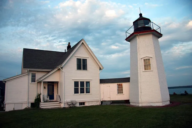
Wing's Neck Light is a lighthouse station on a treeless peninsula in the Pocasset section of Bourne, Massachusetts, where Buzzards Bay meets the approach to the Cape Cod Canal. The present three-story octagonal wooden tower and its keeper's dwelling were built in 1889 after fire destroyed an earlier wooden lighthouse in 1878. A covered walkway later joined the two buildings, and the tower keeps its cast iron lantern room, a distinctive natural wood staircase and a rare copper vent. Two older buildings were added to the grounds: a stone oil house dating from 1849 and a second keeper's house from the 1870s, both floated from Ned Point in Mattapoisett. The light was listed because it is considered the only intact wooden tower connected by a covered walkway to a period keeper's house. Its integrity and scenic setting also contributed to its recognition at the state level, along with its role in the history of navigation aids in Massachusetts.
Significance in brief: The nomination argues the light retains integrity of location, design, setting, materials and workmanship and is tied to the development of aids to navigation in Massachusetts. Built in 1889, it is described as the only intact wooden tower attached by a covered walkway to a period keeper's house. The site also has an 1849 stone oil house and an 1870s second keeper's house, and it has considerable scenic importance.
Machine-generated summary. This summary was generated by a language model from the official nomination document and has not been reviewed line by line by an editor. It may contain errors. Check the source document before relying on any detail. Source: nomination document (PDF) · National Archives catalog entry. NRHP reference 87001503, listed June 15, 1987. Summary generated October 2026 (model claude-sonnet-5-5, prompt v1.0-2026-10-29, confidence medium).
Key facts
| Address | Wing's Neck Rd., Bourne |
|---|---|
| County | Barnstable County |
| Listed | June 15, 1987 |
| Reference number | 87001503 |
| Resource type | Structure |
| Architect / builder | John Vina (built the original 1849 lighthouse) |
| Criteria |
|
| Areas of significance | Engineering, Transportation, Architecture, Maritime History |
| Level of significance | State |
| Status (as stated in the nomination) | Listed as unmanned/inactive. The site has a steel skeleton tower from 1943-45 that holds radar equipment, and a boathouse converted to a dwelling. |
| Acreage | 3.6 |
| Coordinates | 41.68221, -70.65989 (NPS GIS) |
What listing means for this property
National Register listing is honorary: it recognises significance and does not restrict what a private owner may do without federal money or permits. It unlocks the 20% federal rehabilitation tax credit for income-producing buildings, state credits in many states, and Section 106 review when federal agencies are involved. See what listing means in practice.
General information, not legal or tax advice. Rules change; confirm with your State Historic Preservation Office or a qualified adviser.
Sources and further reading
- National Park Service, National Register of Historic Places database (snapshot May 2026), reference 87001503.
- Nomination form (PDF, National Archives) — catalog entry
- Wikipedia article (used for cross-checking only; text not reproduced here)
- Wikidata Q8025064
- This listing as JSON
Last updated October 2026. Found an error? See the editorial policy for how to report it.