Nobska Point Light Station

Why it's listed
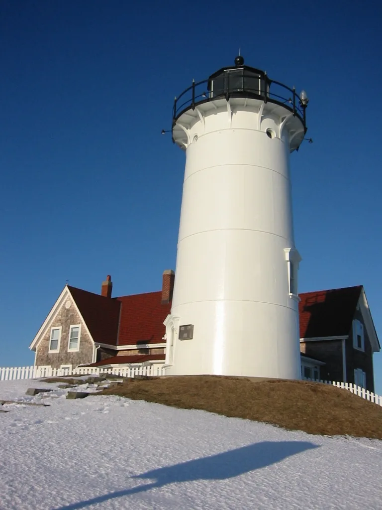
Nobska Point Light Station sits on a bare, rocky promontory east of the entrance to Woods Hole Harbor in Falmouth, visible from all directions. A light was first built on top of a keeper's dwelling after land was purchased in 1828. In 1876 the tower was rebuilt in iron with a brick lining. It is a white cylinder of iron panels, 40 feet high, topped with a cast iron lantern and holding a fourth-order Fresnel lens. The same year brought a wood-frame keeper's dwelling, a brick oil house and a paint locker. A second keeper's house followed in 1900, a garage in 1931 and a brick radio beacon building in 1937. The light was automated in 1985. The complex was recognized for its largely intact 1876 grouping of buildings, its scenic setting, and its strategic location at the meeting of Vineyard Sound, Nantucket Sound and Buzzards Bay, as well as its role in navigation aids in Massachusetts.
Significance in brief: The nomination argues the station is an excellent example of a lighthouse complex dating mainly from 1876, retaining integrity of location, design, setting, materials and workmanship. It is tied to the development of aids to navigation in Massachusetts and is valued for its scenic bluff setting and strategic position where Vineyard and Nantucket Sounds meet Buzzards Bay.
Machine-generated summary. This summary was generated by a language model from the official nomination document and has not been reviewed line by line by an editor. It may contain errors. Check the source document before relying on any detail. Source: nomination document (PDF) · National Archives catalog entry. NRHP reference 87001483, listed June 15, 1987. Summary generated October 2026 (model claude-sonnet-5-5, prompt v1.0-2026-10-29, confidence high).
Key facts
| Address | Nobska Rd., Falmouth |
|---|---|
| County | Barnstable County |
| Listed | June 15, 1987 |
| Reference number | 87001483 |
| Resource type | Structure |
| Architectural style | Italianate tower details and Gothic Revival window moldings on the 1876 keeper's house; radio beacon building described as Federal Revival |
| Criteria |
|
| Areas of significance | Engineering, Transportation, Architecture, Maritime History |
| Level of significance | State |
| Status (as stated in the nomination) | Listed as unmanned/active; the light was automated in 1985 and the living quarters were then used by the Woods Hole group commander. |
| Acreage | 2.1 |
| Coordinates | 41.51653, -70.65685 (NPS GIS) |
What listing means for this property
For a publicly owned building or structure, listing mainly matters when federal funds, permits or licences are involved: projects then go through Section 106 review so effects on the property are considered. Listing also strengthens applications for preservation grants and, for leased income-producing uses, can enable the federal rehabilitation tax credit.
General information, not legal or tax advice. Rules change; confirm with your State Historic Preservation Office or a qualified adviser.
Sources and further reading
- National Park Service, National Register of Historic Places database (snapshot May 2026), reference 87001483.
- Nomination form (PDF, National Archives) — catalog entry
- Wikipedia article (used for cross-checking only; text not reproduced here)
- Wikidata Q16895870
- This listing as JSON
Last updated October 2026. Found an error? See the editorial policy for how to report it.