Bray, Thomas, Farm
Also known as: Heather Hall

Why it's listed
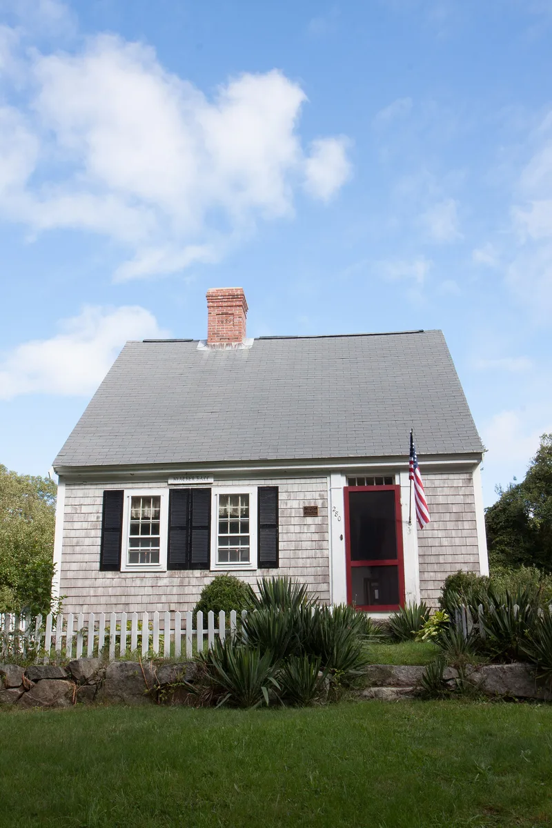
Set on 10.3 acres along Weir Road in Yarmouth, this Cape Cod farmstead centers on a wood-frame half cape built around 1720, possibly earlier. The house keeps its original raised paneling, doors, hardware and fireplace cranes, and its chimney sits off-axis from the entry, a plan found in other Yarmouth examples. Fieldstone walls and old apple, pear, peach and plum orchards run north toward Mill Pond. The Bray and Crowell families held the land for more than 150 years, farming it until the 1860s. In 1922 new owners turned it into a duck hunting lodge and summer home, adding a kitchen wing, a garage built from timbers of an earlier barn, and several small outbuildings by 1926. The property was listed for showing how a small farm lasted through settlement, decline and revival as a tourist landscape, and for one of the region's earliest surviving half capes. Prehistoric and historical archaeological remains are also considered likely.
Significance in brief: The nomination argues the farm is a representative small 18th and 19th century farmstead later converted to seasonal use as Cape Cod became a resort region. The house is an unusually intact early example of the half cape, the most typical regional house form. Together with the fields and 1920s additions, it shows the persistence, decline and recreational conversion of small farms. It is also considered to have high archaeological potential.
Machine-generated summary. This summary was generated by a language model from the official nomination document and has not been reviewed line by line by an editor. It may contain errors. Check the source document before relying on any detail. Source: nomination document (PDF) · National Archives catalog entry. NRHP reference 88001455, listed September 15, 1988. Summary generated October 2026 (model claude-sonnet-5-5, prompt v1.0-2026-10-29, confidence high).
Key facts
| Address | 280 Weir Rd., Yarmouth |
|---|---|
| County | Barnstable County |
| Listed | September 15, 1988 |
| Reference number | 88001455 |
| Resource type | Building |
| Period of significance | ca. 1720-1926 |
| Architectural style | Colonial/New England; Colonial/Georgian |
| Criteria |
|
| Areas of significance | Agriculture, Entertainment/Recreation, Architecture |
| Level of significance | Local |
| Status (as stated in the nomination) | Still used as a single dwelling with agricultural fields; the form says seasonal residential use has continued since the 1920s. |
| Acreage | 10.3 |
| Coordinates | 41.70172, -70.20732 (NPS GIS) |
What listing means for this property
National Register listing is honorary for a privately owned home: it does not by itself restrict what an owner may do with their own money, and it does not require public access. Restrictions come from local landmark or historic-district ordinances, which are separate (how they differ).
Owner-occupied houses are not eligible for the 20% federal rehabilitation tax credit, which applies to income-producing buildings, but many states offer credits for homeowners. Listing also opens the door to preservation easements and to buying a plaque. Start with what listing means for homeowners, renovating a listed house and selling one.
General information, not legal or tax advice. Rules change; confirm with your State Historic Preservation Office or a qualified adviser.
Sources and further reading
- National Park Service, National Register of Historic Places database (snapshot May 2026), reference 88001455.
- Nomination form (PDF, National Archives) — catalog entry
- Wikipedia article (used for cross-checking only; text not reproduced here)
- Wikidata Q7787853
- This listing as JSON
Last updated October 2026. Found an error? See the editorial policy for how to report it.