Lockport Historic District
Also known as: Canal and Downtown Area; See Also:Will County Historical Soci
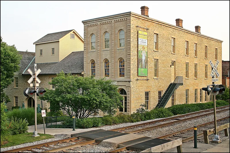

Why it's listed
Lockport's canal and downtown district was planned in 1836 by surveyor Joseph Wampler for the Illinois and Michigan Canal Commissioners, and the town served as canal headquarters from 1838. State Street, 100 feet wide, was laid out parallel to the waterway and only half a block away, a design the nomination says is unmatched among nearby canal towns. The district covers about 31.6 acres of mostly commercial buildings, some of frame or brick but most commonly of locally quarried limestone. Canal-related structures include the Canal Office and Superintendent's home, now a museum, the Hyland Building and the Lockport Iron Works. A fire in 1895 destroyed the east side of State Street between 9th and 10th Streets, and that block was rebuilt in 1895 and 1896. Despite first-floor alterations and two areas of intrusion, the district keeps the look of a 19th-century business district with a continuous townscape.
Significance in brief: The nomination argues the district is a well-preserved example of a 19th-century canal town. Its main street, State Street, runs parallel to the canal and only half a block from it, a layout the form says no other canal town in the area shares. Its buildings span the 1836-1896 canal era and include canal-related structures and local limestone commercial buildings.
Machine-generated summary. This summary was generated by a language model from the official nomination document and has not been reviewed line by line by an editor. It may contain errors. Check the source document before relying on any detail. Source: nomination document (PDF) · National Archives catalog entry. NRHP reference 75000676, listed May 12, 1975. Summary generated October 2026 (model claude-sonnet-5-5, prompt v1.0-2026-10-29, confidence medium).
Key facts
| Address | Area between 7th and 11th Sts. and Canal and Washington Sts., Lockport |
|---|---|
| County | Will County |
| Listed | May 12, 1975 |
| Reference number | 75000676 |
| Resource type | District |
| Period of significance | 19th Century |
| Areas of significance | Community Planning and Development, Commerce, Architecture |
| Level of significance | State |
| Status (as stated in the nomination) | Buildings are described as in good condition, with some first-floor alterations and two areas of modern intrusion. Some buildings, including the Canal Museum, have been partially restored. |
| Acreage | 31.6 |
| Within district | Chicago Sanitary and Ship Canal Historic District |
| Coordinates | 41.58958, -88.05697 (NPS GIS) |
What listing means for this property
This is a historic district. Buildings within its boundary are either contributing (they add to the district's significance) or non-contributing. Owners of contributing income-producing buildings can claim the 20% federal rehabilitation tax credit; homeowners should look at state credits. National Register districts impose no design review by themselves; a local historic district ordinance, if one exists, does (the difference explained).
General information, not legal or tax advice. Rules change; confirm with your State Historic Preservation Office or a qualified adviser.
Sources and further reading
- National Park Service, National Register of Historic Places database (snapshot May 2026), reference 75000676.
- Nomination form (PDF, National Archives) — catalog entry
- Wikipedia article (used for cross-checking only; text not reproduced here)
- Wikidata Q6665743
- This listing as JSON
Last updated October 2026. Found an error? See the editorial policy for how to report it.