Franklin Square
Also known as: Franklin Park Neighbourhood

Why it's listed
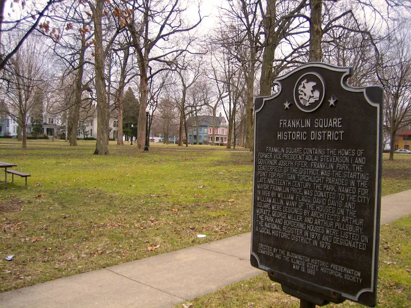
Franklin Square is a city park in Bloomington, Illinois, ringed by 36 houses that together form a Victorian-era neighborhood. The Square measures 591 by 330 feet and lies seven blocks northeast of the downtown courthouse square. Three local leaders deeded it in 1856 for public recreation, and it was named for Franklin Price, then mayor. The park keeps many original oak, maple, ash and buttonwood trees, while the streets on its north and south sides retain 1877 brick paving and sandstone curbs. Twenty-one of the surrounding homes date from the second half of the 1800s, in styles including Queen Anne, Italianate and Romanesque. Their consistent setbacks, spacing and street-facing facades give the area a unified character. Residents included Adlai E. Stevenson I, Governor Joseph W. Fifer, Congressman Frank Funk and attorney John T. Lillard. The park also hosted torch light parades and election celebrations. These features led to its listing as a historic district.
Significance in brief: The nomination argues that the homes around the Square form a cohesive mid-American Victorian neighborhood. Their style, spacing and facades face the park and create a unified setting. The houses also belonged to prominent figures, including a Vice-President, a governor and a congressman, and the park hosted political celebrations.
Machine-generated summary. This summary was generated by a language model from the official nomination document and has not been reviewed line by line by an editor. It may contain errors. Check the source document before relying on any detail. Source: nomination document (PDF) · National Archives catalog entry. NRHP reference 76002164, listed January 11, 1976. Summary generated October 2026 (model claude-sonnet-5-5, prompt v1.0-2026-10-29, confidence medium).
Key facts
| Address | 300 and 400 blocks of E. Chestnut and E. Walnut Sts., 900 block of N. Prairie and N. McLean Sts., Bloomington |
|---|---|
| County | McLean County |
| Listed | January 11, 1976 |
| Reference number | 76002164 |
| Resource type | District |
| Period of significance | 1860-1900 to present |
| Architectural style | Victorian, mixing Queen Anne, Georgian Revival, Romanesque, Bracketed Italianate and Richardsonian |
| Areas of significance | Architecture, Social History |
| Level of significance | State |
| Status (as stated in the nomination) | Nearly all buildings are in use as single or multiple dwellings, with one converted to commercial use. Most are in good repair and relatively unaltered, and the park is in public use. |
| Acreage | 26 |
| Coordinates | 40.48670, -88.99036 (NPS GIS) |
What listing means for this property
This is a historic district. Buildings within its boundary are either contributing (they add to the district's significance) or non-contributing. Owners of contributing income-producing buildings can claim the 20% federal rehabilitation tax credit; homeowners should look at state credits. National Register districts impose no design review by themselves; a local historic district ordinance, if one exists, does (the difference explained).
General information, not legal or tax advice. Rules change; confirm with your State Historic Preservation Office or a qualified adviser.
Sources and further reading
- National Park Service, National Register of Historic Places database (snapshot May 2026), reference 76002164.
- Nomination form (PDF, National Archives) — catalog entry
- Wikipedia article (used for cross-checking only; text not reproduced here)
- Wikidata Q5491844
- This listing as JSON
Last updated October 2026. Found an error? See the editorial policy for how to report it.