Nauvoo Historic District

Why it's listed
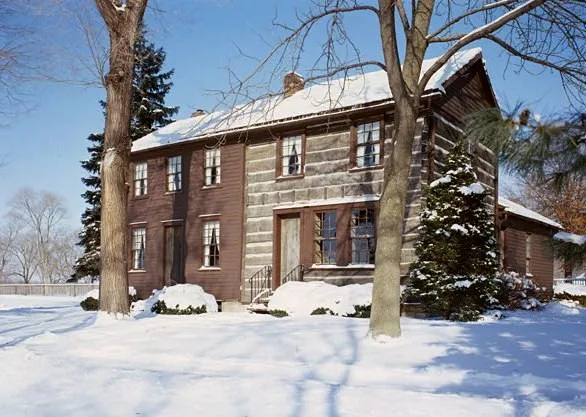
Nauvoo lies on a bend of the Mississippi River in Hancock County, Illinois. Mormon settlers bought land around the small town of Commerce in 1839 and renamed it Nauvoo. Within a few years the city reached an estimated 12,000 residents and was for a time the largest in Illinois. It served as church headquarters until the Mormons left in 1846. Surviving buildings include the Mansion House, Nauvoo House, the Joseph Smith Homestead, the Masonic Temple and several homes of church leaders, most of them plain brick houses of two or two and a half stories. The temple, burned in 1848 and later toppled by a tornado, was located through archaeological digs in the 1960s. After 1846 a French communal group, the Icarians, occupied the town and introduced wine and cheese making. Restoration groups have since worked to return parts of the town to its appearance around 1846.
Significance in brief: Nauvoo was the principal city and church headquarters of the Mormons from 1839 to 1846. It grew within a few years to an estimated 12,000 people, for a time the largest city in Illinois. Surviving homes and public buildings, along with excavated sites such as the temple, document this period. The later Icarian communal colony adds a second layer of history.
Machine-generated summary. This summary was generated by a language model from the official nomination document and has not been reviewed line by line by an editor. It may contain errors. Check the source document before relying on any detail. Source: nomination document (PDF) · National Archives catalog entry. NRHP reference 66000321, listed October 15, 1966. Summary generated October 2026 (model claude-sonnet-5-5, prompt v1.0-2026-10-29, confidence medium).
Key facts
| Address | Nauvoo and its environs, Nauvoo |
|---|---|
| County | Hancock County |
| Listed | October 15, 1966 |
| Reference number | 66000321 |
| Resource type | District |
| Period of significance | 1839-1846 (Morman Occupation) |
| Architectural style | Greek Revival (Mansion House); most Mormon houses are simple rectangular brick buildings |
| Areas of significance | Exploration/Settlement, Religion |
| Level of significance | National |
| National Historic Landmark | Yes, designated January 20, 1961 |
| Status (as stated in the nomination) | Mixed public and private ownership; condition marked good and occupied. Restoration, excavation and reconstruction programs were under way at the time of the form. |
| Acreage | 3850 |
| Coordinates | 40.55751, -91.37212 (NPS GIS) |
What listing means for this property
This is a historic district. Buildings within its boundary are either contributing (they add to the district's significance) or non-contributing. Owners of contributing income-producing buildings can claim the 20% federal rehabilitation tax credit; homeowners should look at state credits. National Register districts impose no design review by themselves; a local historic district ordinance, if one exists, does (the difference explained).
General information, not legal or tax advice. Rules change; confirm with your State Historic Preservation Office or a qualified adviser.
Sources and further reading
- National Park Service, National Register of Historic Places database (snapshot May 2026), reference 66000321.
- Nomination form (PDF, National Archives) — catalog entry
- Wikipedia article (used for cross-checking only; text not reproduced here)
- Wikidata Q6981534
- This listing as JSON
Last updated October 2026. Found an error? See the editorial policy for how to report it.