McCarty Subdivision Historic District

Why it's listed
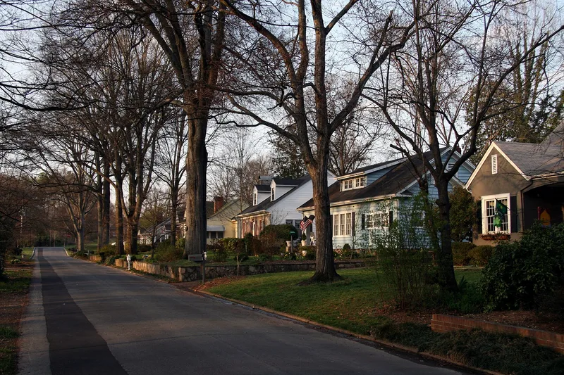
West of downtown Dalton, Georgia, this 14-acre neighborhood was platted in 1928 as the McCarty Subdivision and built out mostly between 1929 and the early 1950s. It holds 34 contributing buildings, mainly one- and two-story houses plus two apartment buildings from the early 1940s that were designed to resemble single-family homes. The oldest house, a Queen Anne dwelling from 1882, was moved to the site in 1929 and now anchors the view down Thornton Place. Other houses show Colonial Revival, Craftsman, English Vernacular Revival and Minimal Traditional styles. The layout includes curving and straight streets, a tree-shaded median along a creek on Willow Park Drive, broad lawns and mature water oaks. The district was recognized for its architecture and for its intact plan, which the nomination describes as the first automobile subdivision in Dalton and an example of New South landscape design. Four later or altered buildings do not contribute.
Significance in brief: It is described as one of Dalton's earliest planned subdivisions and its first automobile subdivision, with an intact plan of curvilinear and linear streets, a landscaped median and New South landscaping. It also holds a good collection of early- to mid-20th century house types and styles typical of Georgia, including Queen Anne, Colonial Revival, Craftsman and English Vernacular Revival.
Machine-generated summary. This summary was generated by a language model from the official nomination document and has not been reviewed line by line by an editor. It may contain errors. Check the source document before relying on any detail. Source: nomination document (PDF) · National Archives catalog entry. NRHP reference 02000714, listed July 5, 2002. Summary generated October 2026 (model claude-sonnet-5-5, prompt v1.0-2026-10-29, confidence high).
Key facts
| Address | Thornton Place, Willow Park Dr., Sunset Cirtcle, and Walnut Ave., Dalton |
|---|---|
| County | Whitfield County |
| Listed | July 5, 2002 |
| Reference number | 02000714 |
| Resource type | District |
| Period of significance | 1928-1952 |
| Architectural style | Late Victorian/Queen Anne; Colonial Revival; Craftsman/Bungalow; English Vernacular Revival; Minimal Traditional; Ranch House |
| Criteria |
|
| Areas of significance | Architecture, Community Planning and Development, Landscape Architecture |
| Level of significance | Local |
| Status (as stated in the nomination) | Retains a high level of integrity; historic functions as single dwellings and apartment buildings continue. Some houses and an apartment building were demolished and their sites excluded from the boundary. |
| Acreage | 14 |
| Coordinates | 34.75988, -84.97229 (NPS GIS) |
What listing means for this property
This is a historic district. Buildings within its boundary are either contributing (they add to the district's significance) or non-contributing. Owners of contributing income-producing buildings can claim the 20% federal rehabilitation tax credit; homeowners should look at state credits. National Register districts impose no design review by themselves; a local historic district ordinance, if one exists, does (the difference explained).
General information, not legal or tax advice. Rules change; confirm with your State Historic Preservation Office or a qualified adviser.
Sources and further reading
- National Park Service, National Register of Historic Places database (snapshot May 2026), reference 02000714.
- Nomination form (PDF, National Archives) — catalog entry
- Wikidata Q141812499
- This listing as JSON
Last updated October 2026. Found an error? See the editorial policy for how to report it.