Covington Mills and Mill Village Historic District

Why it's listed
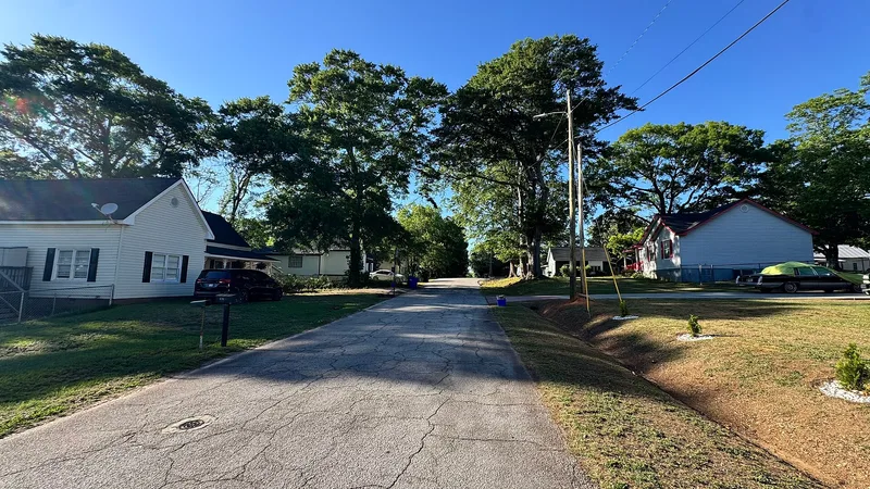
Covington Mills and its adjoining village form a historic district of about 60 acres in Covington, Georgia. The mill company founded the community in 1900 to house its workers. The brick mill itself was damaged by fire in 1986 and later demolished, but its concrete slab, the mill pond, a water tower and several warehouses remain north of the rail line. South of the tracks, the village contains saddlebag, gabled-ell, pyramidal and shotgun houses, a mill store, a cemetery and two Colonial Revival churches, one built by the company in 1920 as a joint Methodist and Baptist church and school. Its curving streets follow the terrain, which sets it apart from the gridiron plans of most mill villages. The district was listed for its role in the industrial growth of Covington and Newton County, as an intact planned mill community, and for housing types typical of Georgia Piedmont mill villages between 1900 and 1949.
Significance in brief: The district is argued to be significant for industry, community planning and architecture. It is an intact, company-planned mill village with a "contour of the site" street plan, unlike the gridiron layouts of most mill villages. Its house types and Colonial Revival churches are representative of Georgia Piedmont mill communities, and the mill was once Newton County's second-largest employer.
Machine-generated summary. This summary was generated by a language model from the official nomination document and has not been reviewed line by line by an editor. It may contain errors. Check the source document before relying on any detail. Source: nomination document (PDF) · National Archives catalog entry. NRHP reference 00000370, listed April 14, 2000. Summary generated October 2026 (model claude-sonnet-5-5, prompt v1.0-2026-10-29, confidence high).
Key facts
| Address | Roughly bounded by Wheat, Collins and Lott Sts. and, to the norht, the Covington Mills pond and Creek, Covington |
|---|---|
| County | Newton County |
| Listed | April 14, 2000 |
| Reference number | 00000370 |
| Resource type | District |
| Period of significance | 1900-1949 |
| Architectural style | Colonial Revival; vernacular mill house types (saddlebag, gabled-ell, pyramidal, central-hall, shotgun) |
| Criteria |
|
| Areas of significance | Architecture, Industry, Community Planning and Development |
| Level of significance | Local |
| Status (as stated in the nomination) | The mill building burned in 1986 and was later demolished; only its slab foundation, the pond, water tower and some secondary buildings remain. The village is described as intact, and nearly all houses are now single-family residences. |
| Acreage | 60 |
| Coordinates | 33.60768, -83.84588 (NPS GIS) |
What listing means for this property
This is a historic district. Buildings within its boundary are either contributing (they add to the district's significance) or non-contributing. Owners of contributing income-producing buildings can claim the 20% federal rehabilitation tax credit; homeowners should look at state credits. National Register districts impose no design review by themselves; a local historic district ordinance, if one exists, does (the difference explained).
General information, not legal or tax advice. Rules change; confirm with your State Historic Preservation Office or a qualified adviser.
Sources and further reading
- National Park Service, National Register of Historic Places database (snapshot May 2026), reference 00000370.
- Nomination form (PDF, National Archives) — catalog entry
- Wikidata Q141796935
- This listing as JSON
Last updated October 2026. Found an error? See the editorial policy for how to report it.