Penn Place

Why it's listed
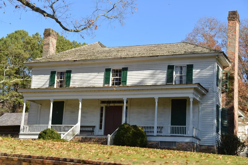
Penn Place is a farmstead of about 275 acres along the Chattooga River near Trion, Georgia. Its main house, a two-over-two Plantation Plain frame dwelling, was built in the early 1850s with hand-hewn, pegged framing and hand-made brick chimneys. The family added a kitchen ell, a farm office and a bedroom in 1875, and a sunroom and baths in 1973, yet the house looks much as it did originally. Eight outbuildings survive, including a log smokehouse, an octagonal well house, a dovecote, a servants' house, a carbide gas generator house, a mule barn and a corn crib. The property was bought by William Penn in 1849, passed to his son James in 1850, and has stayed with the family since. Cotton and corn were grown here, first with enslaved labor and later through tenant farming. The farm is also tied to a Civil War river crossing at Penn's Ford in 1864. It was listed for its architecture and its record of continuous family farming.
Significance in brief: The nomination argues it is significant under Criterion A as a farm held by the same founding family from the 1850s to the present, representing westward settlement on former Cherokee lands. Under Criterion C, the main house and outbuildings embody the Plantation Plain style and a self-contained 19th-century farmstead. Changes were made by the family about once a generation, leaving the house much as it looked in the 1850s.
Machine-generated summary. This summary was generated by a language model from the official nomination document and has not been reviewed line by line by an editor. It may contain errors. Check the source document before relying on any detail. Source: nomination document (PDF) · National Archives catalog entry. NRHP reference 88001828, listed September 29, 1988. Summary generated October 2026 (model claude-sonnet-5-5, prompt v1.0-2026-10-29, confidence high).
Key facts
| Address | Penn Bridge Rd., Trion |
|---|---|
| County | Chattooga County |
| Listed | September 29, 1988 |
| Reference number | 88001828 |
| Resource type | District |
| Period of significance | 1850-1938 |
| Architectural style | Plantation Plain |
| Criteria |
|
| Areas of significance | Agriculture, Architecture |
| Level of significance | Local |
| Status (as stated in the nomination) | In good condition following a 1973 restoration and continued occupation by the same family; the setting remains very rural. |
| Acreage | 275 |
| Coordinates | 34.51605, -85.30582 (NPS GIS) |
What listing means for this property
This is a historic district. Buildings within its boundary are either contributing (they add to the district's significance) or non-contributing. Owners of contributing income-producing buildings can claim the 20% federal rehabilitation tax credit; homeowners should look at state credits. National Register districts impose no design review by themselves; a local historic district ordinance, if one exists, does (the difference explained).
General information, not legal or tax advice. Rules change; confirm with your State Historic Preservation Office or a qualified adviser.
Sources and further reading
- National Park Service, National Register of Historic Places database (snapshot May 2026), reference 88001828.
- Nomination form (PDF, National Archives) — catalog entry
- Wikipedia article (used for cross-checking only; text not reproduced here)
- Wikidata Q55316110
- This listing as JSON
Last updated October 2026. Found an error? See the editorial policy for how to report it.