St. Marys Historic District
Also known as: City of St. Mary's; See Also:Orange Hall

Why it's listed
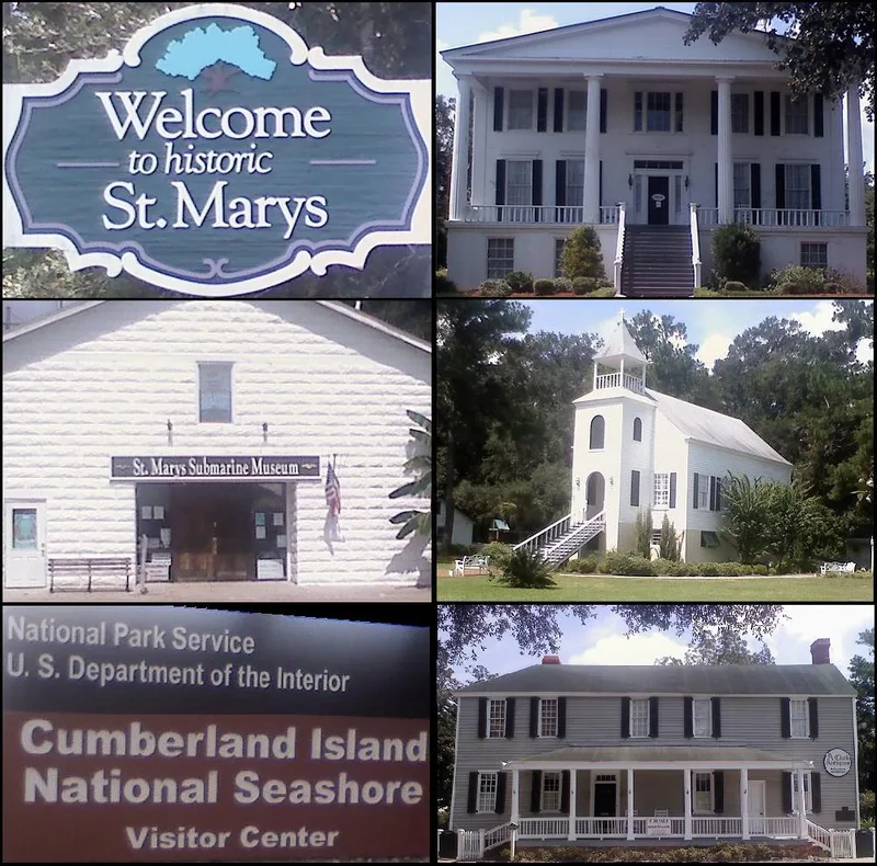
St. Marys is a small seaport town on the north bank of the St. Marys River in southeastern Georgia, laid out in a square grid in 1788 with six public squares. The historic district covers about 230 acres and keeps the original street plan almost unchanged. Osborne Street, the main avenue, holds the Washington Oak and Pump of 1799, the Archibald Clarke House of 1801-1805, the Rudolph House and the 1914 Riverview Hotel. Other streets contain the Pratt-Gillican House of 1825, an early raised cottage, and the Presbyterian Church of 1808, known for a bell cast by Paul Revere. Oak Grove Cemetery holds graves dating from 1801. The town was a busy port from 1787 to the mid-1840s, trading in lumber, fruit, vegetables and sea-island cotton, and twice served as Camden County seat. It was listed as an example of an early port city with good early houses and churches.
Significance in brief: The nomination argues that St. Marys is an excellent example of an early port city and a typical outpost in a sparsely settled area. It was a busy seaport from 1787 to the mid-1840s and served as Camden County seat during two periods. Many of its individual houses and churches are good examples of early residential and religious architecture in Georgia.
Machine-generated summary. This summary was generated by a language model from the official nomination document and has not been reviewed line by line by an editor. It may contain errors. Check the source document before relying on any detail. Source: nomination document (PDF) · National Archives catalog entry. NRHP reference 76000609, listed May 13, 1976. Summary generated October 2026 (model claude-sonnet-5-5, prompt v1.0-2026-10-29, confidence medium).
Key facts
| Address | Roughly bounded by Waterfront Rd., Norris, Alexander, and Oak Grove Cemetery, St. Marys |
|---|---|
| County | Camden County |
| Listed | May 13, 1976 |
| Reference number | 76000609 |
| Resource type | District |
| Architectural style | Plantation plain, Sand Hills raised cottage and other early Georgia residential and religious buildings |
| Areas of significance | Community Planning and Development, Exploration/Settlement, Architecture |
| Level of significance | State |
| Status (as stated in the nomination) | Described as good to altered in condition. The waterfront is much deteriorated and no longer a working harbor. The district is mostly in private residential use, with some religious, park and museum uses. |
| Acreage | 230 |
| Coordinates | 30.74356, -81.55650 (NPS GIS) |
What listing means for this property
This is a historic district. Buildings within its boundary are either contributing (they add to the district's significance) or non-contributing. Owners of contributing income-producing buildings can claim the 20% federal rehabilitation tax credit; homeowners should look at state credits. National Register districts impose no design review by themselves; a local historic district ordinance, if one exists, does (the difference explained).
General information, not legal or tax advice. Rules change; confirm with your State Historic Preservation Office or a qualified adviser.
Sources and further reading
- National Park Service, National Register of Historic Places database (snapshot May 2026), reference 76000609.
- Nomination form (PDF, National Archives) — catalog entry
- Wikipedia article (used for cross-checking only; text not reproduced here)
- Wikidata Q7590569
- This listing as JSON
Last updated October 2026. Found an error? See the editorial policy for how to report it.