McIntosh, John Houstoun, Sugarhouse

Why it's listed
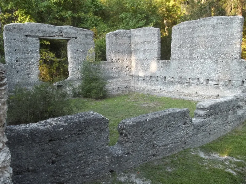
Six miles north of St. Marys, Georgia, near the Kings Bay Naval Base gate, stand the tabby ruins of a sugarhouse built around 1826 for planter John Houstoun McIntosh. Tabby, a coastal material made from oyster shell, lime, sand and water, forms walls about 14 feet high enclosing three rooms: a two-story milling room, a boiling room and a curing room, with porches on the north and south sides. Animals powered a horizontal roller mill bought from the West Point Foundry in New York, the first of its kind used in Georgia. McIntosh also received a patent in 1829 for a method of clarifying cane juice. Later the building processed arrowroot starch during the Civil War. Archaeologists from the University of Florida worked there in 1981 and confirmed that the ruin was a sugar mill, not a Spanish mission as once believed. The surrounding ground remains largely unexamined and may hold further evidence of sugar production.
Significance in brief: The nomination argues it is one of the few remaining remnants of Georgia's coastal sugar industry and a rare example of a tabby industrial building. It was the first Georgia mill to use a horizontal roller mill. Archaeology in 1981 confirmed its function as a sugar mill rather than a Spanish mission, and unexamined areas around the walls may yield more information.
Machine-generated summary. This summary was generated by a language model from the official nomination document and has not been reviewed line by line by an editor. It may contain errors. Check the source document before relying on any detail. Source: nomination document (PDF) · National Archives catalog entry. NRHP reference 92000167, listed April 2, 1992. Summary generated October 2026 (model claude-sonnet-5-5, prompt v1.0-2026-10-29, confidence high).
Key facts
| Address | Ga. Spur 40, 6 mi. N of St. Marys, St. Marys |
|---|---|
| County | Camden County |
| Listed | April 2, 1992 |
| Reference number | 92000167 |
| Resource type | Site |
| Period of significance | C. 1826 - 1865 |
| Architectural style | No style |
| Criteria |
|
| Areas of significance | Industry, Historic - Non-Aboriginal |
| Level of significance | State |
| Status (as stated in the nomination) | Current function is listed as ruins; the tabby walls stand about 14 feet high, though none of the mill equipment remains. |
| Acreage | 1 |
| Coordinates | 30.79322, -81.57845 (NPS GIS) |
What listing means for this property
Sites (archaeological sites, battlefields, landscapes) are often listed with a restricted address to protect them from looting or disturbance. Listing is honorary for private owners; federal undertakings on or near the site go through Section 106 review, and state laws may protect burials and artefacts regardless of listing.
General information, not legal or tax advice. Rules change; confirm with your State Historic Preservation Office or a qualified adviser.
Sources and further reading
- National Park Service, National Register of Historic Places database (snapshot May 2026), reference 92000167.
- Nomination form (PDF, National Archives) — catalog entry
- Wikipedia article (used for cross-checking only; text not reproduced here)
- Wikidata Q17021020
- This listing as JSON
Last updated October 2026. Found an error? See the editorial policy for how to report it.