Highway 152 Tree Row
Also known as: Hecker Highway Tree Row

Why it's listed
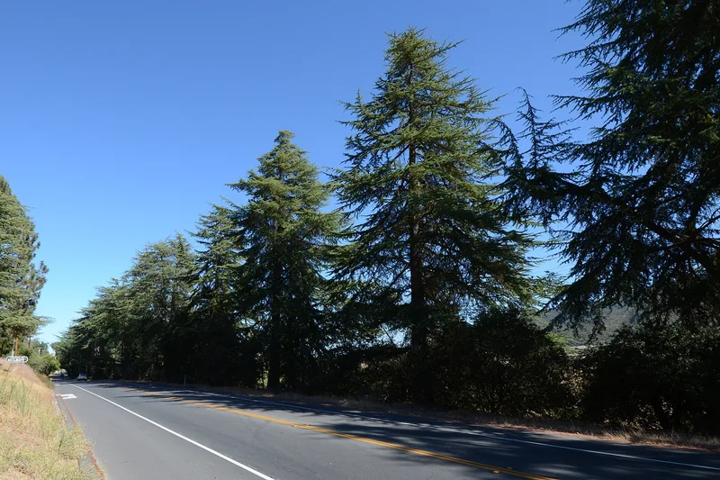
A row of deodar cedars runs for 1.39 miles along the south side of Highway 152, west of Gilroy, California. The trees stand about three feet from the pavement, roughly 20 feet apart, and reach 30 to 40 feet in height. Oaks grow among them at the western end. The cedars were planted by Gilroy residents on California's Arbor Days, March 7, 1930 and 1931. The Rotary Club led the effort, joined by Elks, Boy Scouts, Camp Fire Girls, the American Legion Auxiliary and schoolchildren. Seventy-five trees went in during 1930 and 65 more the following year. They honored the newly built Hecker Pass Highway, named for county supervisor Henry Hecker, which became the main western entrance to Gilroy. The row is the lone survivor of the town's early street beautification efforts, and the surrounding setting remains rural. It was recognized for its link to local civic improvement during the statewide Arbor Day observances.
Significance in brief: The tree row is argued to be significant under Criterion A in social history at the local level. It reflects Gilroy's civic improvement and highway beautification efforts during California's first statewide Arbor Days. It is described as the only surviving remnant of Gilroy's early street beautification program.
Machine-generated summary. This summary was generated by a language model from the official nomination document and has not been reviewed line by line by an editor. It may contain errors. Check the source document before relying on any detail. Source: nomination document (PDF) · National Archives catalog entry. NRHP reference 07000635, listed July 3, 2007. Summary generated October 2026 (model claude-sonnet-5-5, prompt v1.0-2026-10-29, confidence high).
Key facts
| Address | CA 152, Gilroy |
|---|---|
| County | Santa Clara County |
| Listed | July 3, 2007 |
| Reference number | 07000635 |
| Resource type | Site |
| Period of significance | 1930-1931 |
| Architectural style | No Style |
| Criteria |
|
| Areas of significance | Social History |
| Level of significance | Local |
| Status (as stated in the nomination) | Trees are described as in good health, with about five gaps in the row and no significant changes since 2004. |
| Acreage | 1.4 |
| Coordinates | 37.01164, -121.61611 (NPS GIS) |
What listing means for this property
Sites (archaeological sites, battlefields, landscapes) are often listed with a restricted address to protect them from looting or disturbance. Listing is honorary for private owners; federal undertakings on or near the site go through Section 106 review, and state laws may protect burials and artefacts regardless of listing.
General information, not legal or tax advice. Rules change; confirm with your State Historic Preservation Office or a qualified adviser.
Sources and further reading
- National Park Service, National Register of Historic Places database (snapshot May 2026), reference 07000635.
- Nomination form (PDF, National Archives) — catalog entry
- Wikidata Q108839997
- This listing as JSON
Last updated October 2026. Found an error? See the editorial policy for how to report it.