Old Mission Dam
Also known as: Padre Dam

Why it's listed
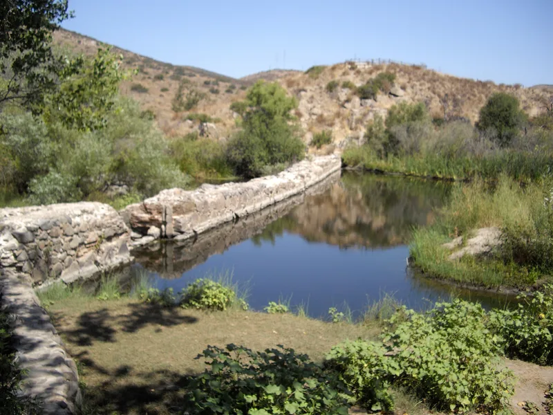
Old Mission Dam is a cobblestone-and-cement structure across the San Diego River near the head of Mission Gorge in San Diego. Originally about 220 feet long, 12 feet high and 13 feet thick, it was built to hold back river water that ran dry in summer. A gate released water as needed, and a tile flume resting on cobblestones and cement carried it roughly five miles to Mission San Diego de Alcala. The dam was probably begun around 1803, after drought years, and the irrigation system had reached its final form by 1817. It supplied the mission's fields, mill and household needs through the year, and is regarded as perhaps the first major irrigation-engineering project on the Pacific Coast of the United States. Floods and neglect left the works in ruins by 1867, though the dam was repaired about 1874. A large part of it still stands and holds back water, but almost nothing of the aqueduct remains. The listed area is about a quarter acre around the dam.
Significance in brief: The dam, with its aqueduct and flume running about five miles to the mission, is described as perhaps the first major irrigation-engineering project on the Pacific Coast of the United States. It gave the mission a year-round water supply for fields, milling and domestic use. Only the dam survives in meaningful form, and it still backs up some water.
Machine-generated summary. This summary was generated by a language model from the official nomination document and has not been reviewed line by line by an editor. It may contain errors. Check the source document before relying on any detail. Source: nomination document (PDF) · National Archives catalog entry. NRHP reference 66000225, listed October 15, 1966. Summary generated October 2026 (model claude-sonnet-5-5, prompt v1.0-2026-10-29, confidence medium).
Key facts
| Address | N side of Mission St.-Gorge Rd., San Diego |
|---|---|
| County | San Diego County |
| Listed | October 15, 1966 |
| Reference number | 66000225 |
| Resource type | Structure |
| Period of significance | 1800-1899 |
| Areas of significance | Engineering, Agriculture |
| Level of significance | National |
| National Historic Landmark | Yes, designated May 21, 1963 |
| Status (as stated in the nomination) | Condition marked deteriorated and unaltered; a considerable portion of the dam still stands and impounds water, while nearly all of the aqueduct is gone. The dam is publicly owned and used as a park and historic site. |
| Acreage | 0.3 |
| Coordinates | 32.83971, -117.04322 (NPS GIS) |
What listing means for this property
For a publicly owned building or structure, listing mainly matters when federal funds, permits or licences are involved: projects then go through Section 106 review so effects on the property are considered. Listing also strengthens applications for preservation grants and, for leased income-producing uses, can enable the federal rehabilitation tax credit.
General information, not legal or tax advice. Rules change; confirm with your State Historic Preservation Office or a qualified adviser.
Sources and further reading
- National Park Service, National Register of Historic Places database (snapshot May 2026), reference 66000225.
- Nomination form (PDF, National Archives) — catalog entry
- Wikipedia article (used for cross-checking only; text not reproduced here)
- Wikidata Q7084554
- This listing as JSON
Last updated October 2026. Found an error? See the editorial policy for how to report it.