Kuchamaa
Also known as: Tecate Peak
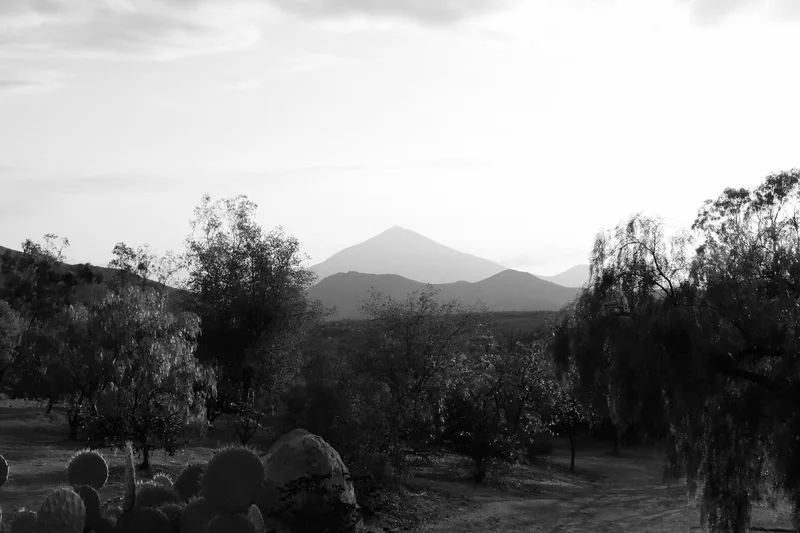

Why it's listed
Tecate Peak, known to the Kumeyaay as Kuchamaa, is a rugged granite mountain rising 3,885 feet beside the International Border in southern San Diego County. The nominated district takes in 510 acres from the 3,000-foot contour to the summit. Its importance is religious. According to Kumeyaay tradition, the creator god Maiha selected the mountain, and it became the place where shamans gained knowledge and power and instructed their initiates. Vision quests, purification rites and prayers at the full moon and equinoxes continue today, and people from other Native groups in southern California and Baja California also visited. The mountain has been altered by a road built in the late 1930s and by communications buildings first placed on the summit in 1942, which is why the period of significance ends that year. Kumeyaay opposition stopped a power line route in 1979 and a park proposal in 1981. The peak was listed for its association with Native American religious heritage.
Significance in brief: The nomination argues the peak is a sacred mountain of paramount religious importance to the Kumeyaay people, chosen by the creator god Maiha and used for shaman initiation, vision quests and purification ceremonies. It is argued to meet Criterion A for its association with Native American religious history, with significance at the local level. Despite communications facilities on the summit, it is said to retain integrity of feeling and association.
Machine-generated summary. This summary was generated by a language model from the official nomination document and has not been reviewed line by line by an editor. It may contain errors. Check the source document before relying on any detail. Source: nomination document (PDF) · National Archives catalog entry. NRHP reference 92001268, listed October 6, 1992. Summary generated October 2026 (model claude-sonnet-5-5, prompt v1.0-2026-10-29, confidence high).
Key facts
| Address | SE of San Diego at the US--Mexico border, Tecate |
|---|---|
| County | San Diego County |
| Listed | October 6, 1992 |
| Reference number | 92001268 |
| Resource type | District |
| Period of significance | Ethnographic to 1942 |
| Criteria |
|
| Areas of significance | Religion |
| Level of significance | Local |
| Status (as stated in the nomination) | Not pristine: a communications facility with two small cinder block buildings and an access road occupy the summit, but the mountain is still used by the Kumeyaay and Juaneno for ceremonies. |
| Acreage | 510 |
| Coordinates | 32.57817, -116.69144 (NPS GIS) |
What listing means for this property
This is a historic district. Buildings within its boundary are either contributing (they add to the district's significance) or non-contributing. Owners of contributing income-producing buildings can claim the 20% federal rehabilitation tax credit; homeowners should look at state credits. National Register districts impose no design review by themselves; a local historic district ordinance, if one exists, does (the difference explained).
General information, not legal or tax advice. Rules change; confirm with your State Historic Preservation Office or a qualified adviser.
Sources and further reading
- National Park Service, National Register of Historic Places database (snapshot May 2026), reference 92001268.
- Nomination form (PDF, National Archives) — catalog entry
- Wikipedia article (used for cross-checking only; text not reproduced here)
- Wikidata Q5960834
- This listing as JSON
Last updated October 2026. Found an error? See the editorial policy for how to report it.