Initial Point of Boundary Between U.S. and Mexico
Also known as: Western Land Boundary Marker No. 258, U.S. & Mexico

Why it's listed
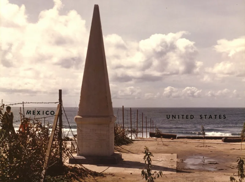
Monument No. 258 is a marble obelisk at the Pacific end of the border between the United States and Mexico, reached through Border State Park southwest of San Diego. It began in 1849 as a cairn of rocks, set after the Treaty of Guadalupe Hidalgo. A white marble shaft made in New York was carried around the Horn on the USS Supply and dedicated at the site in June 1851. Visitors had so damaged it by 1894 that the Barlow-Blanco Commission had it renovated, rebuilt on the spot and fenced. The inscription on its west face names the initial point of the boundary, established by the Joint Commission on 10 October 1849, with John B. Weller as U.S. Commissioner and Andrew B. Gray as U.S. Surveyor. As the westernmost boundary marker, it fixes the southwestern corner of the continental United States. The monument straddles the line, half in each country, and is under the jurisdiction of the International Boundary and Water Commission.
Significance in brief: Monument No. 258 marks the initial point of the boundary fixed by the Joint Commission under the Treaty of Guadalupe Hidalgo. It is the westernmost boundary marker between the United States and Mexico and marks the southwestern corner of the continental United States.
Machine-generated summary. This summary was generated by a language model from the official nomination document and has not been reviewed line by line by an editor. It may contain errors. Check the source document before relying on any detail. Source: nomination document (PDF) · National Archives catalog entry. NRHP reference 74000550, listed September 6, 1974. Summary generated October 2026 (model claude-sonnet-5-5, prompt v1.0-2026-10-29, confidence medium).
Key facts
| Address | S of Imperial Beach off Monument Rd., San Diego |
|---|---|
| County | San Diego County |
| Listed | September 6, 1974 |
| Reference number | 74000550 |
| Resource type | Site |
| Period of significance | 19th Century |
| Areas of significance | Politics/Government |
| Level of significance | Local |
| Status (as stated in the nomination) | Condition is stated as good and altered, at its original site; the 1894 reconstructed marble monument still stands, with normal wear and some slight vandalism. The south half of the monument is in Mexico and the north half in the United States. |
| Acreage | 0.1 |
| Coordinates | 32.53455, -117.12290 (NPS GIS) |
What listing means for this property
Sites (archaeological sites, battlefields, landscapes) are often listed with a restricted address to protect them from looting or disturbance. Listing is honorary for private owners; federal undertakings on or near the site go through Section 106 review, and state laws may protect burials and artefacts regardless of listing.
General information, not legal or tax advice. Rules change; confirm with your State Historic Preservation Office or a qualified adviser.
Sources and further reading
- National Park Service, National Register of Historic Places database (snapshot May 2026), reference 74000550.
- Nomination form (PDF, National Archives) — catalog entry
- Wikipedia article (used for cross-checking only; text not reproduced here)
- Wikidata Q2892431
- This listing as JSON
Last updated October 2026. Found an error? See the editorial policy for how to report it.