Cabrillo National Monument
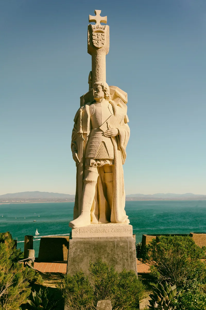

Why it's listed
Cabrillo National Monument covers about 144 acres near the south end of Point Loma in San Diego, rising to 422 feet at the peninsula's highest point. It was first designated to commemorate Juan Rodriguez Cabrillo's voyage and his discovery of San Diego Bay. The land was formerly part of Fort Rosecrans, headquarters of the harbor defenses of San Diego, and most of its historic resources reflect that military role. These include a 1918 radio station, concrete fire control stations used to aim coastal guns, searchlight shelters and a generator plant built in 1918-1919, the World War II Battery Bluff and Battery Point Loma, and the Bayside Trail, originally an Army road. The Old Point Loma Lighthouse, built of sandstone in 1854 and first lit in 1855, predates the military presence but was also used during both world wars. The district has 26 contributing and 8 noncontributing resources. Some structures have been sealed because of vandalism.
Significance in brief: The nomination documents the resources within the monument. Most relate to the role of Point Loma in the harbor defenses of San Diego, including fire control stations, searchlight shelters, a radio station, and gun batteries. The monument was also designated to commemorate Juan Rodriguez Cabrillo's voyage and his discovery of San Diego Bay, and the 1854 lighthouse predates the military use.
Machine-generated summary. This summary was generated by a language model from the official nomination document and has not been reviewed line by line by an editor. It may contain errors. Check the source document before relying on any detail. Source: nomination document (PDF) · National Archives catalog entry. NRHP reference 66000224, listed October 15, 1966. Summary generated October 2026 (model claude-sonnet-5-5, prompt v1.0-2026-10-29, confidence medium).
Key facts
| Address | 10 mi. from San Diego off U.S. 10, near S tip of Point Loma, San Diego |
|---|---|
| County | San Diego County |
| Listed | October 15, 1966 |
| Reference number | 66000224 |
| Resource type | District |
| Architectural style | Other: Military; Late 19th and 20th Century Revivals |
| Areas of significance | Exploration/Settlement, Conservation, Architecture |
| Level of significance | National, State, Local |
| Status (as stated in the nomination) | Several structures are sealed or filled in because of vandalism, and their interior condition is unknown. The radio station is used for storage. The Bayside Trail is closed to ordinary vehicle traffic. |
| Acreage | 143.9 |
| Coordinates | 32.66987, -117.24094 (NPS GIS) |
What listing means for this property
This is a historic district. Buildings within its boundary are either contributing (they add to the district's significance) or non-contributing. Owners of contributing income-producing buildings can claim the 20% federal rehabilitation tax credit; homeowners should look at state credits. National Register districts impose no design review by themselves; a local historic district ordinance, if one exists, does (the difference explained).
General information, not legal or tax advice. Rules change; confirm with your State Historic Preservation Office or a qualified adviser.
Sources and further reading
- National Park Service, National Register of Historic Places database (snapshot May 2026), reference 66000224.
- Nomination form (PDF, National Archives) — catalog entry
- Wikipedia article (used for cross-checking only; text not reproduced here)
- Wikidata Q1024971
- This listing as JSON
Last updated October 2026. Found an error? See the editorial policy for how to report it.