Victoria Avenue

The pin is a point inside the NPS boundary polygon, not a surveyed location.
Why it's listed
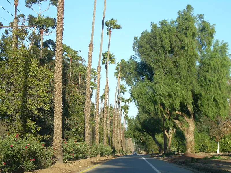
Victoria Avenue in Riverside, California, is a divided boulevard about 6.1 miles long and 120 feet wide, running from Arlington Avenue to Boundary Lane. It was graded in 1892 as the main route through the Arlington Heights subdivision, which was developed with citrus groves and large-lot grove houses. Two roadways flank a wide median originally meant for a streetcar line that was never built. Planting began in 1893, and Mexican Fan Palms, eucalyptus, peppers, cypresses and later Ragged Robin roses and Crape Myrtle shaped its park-like character. Landscape architect Franz Hosp is credited with the original tree planting concept. The avenue was conceived as an attractive drive to and from downtown, helping promote the subdivision, the city and the citrus industry. It retains its original alignment and cross-section despite added turn lanes, bike paths and residential development since the 1970s. Its significance rests on community planning and development and on its design as a landscaped parkway.
Significance in brief: The nomination argues that the avenue is a defining element of Riverside's historic citrus landscape and was designed as a showpiece drive to promote the subdivision, the city and the citrus industry. It is significant locally in community planning and development, and as a designed landscape with a planted median and tree-lined edges. It retains its original alignment and cross-section and its historic planting pattern.
Machine-generated summary. This summary was generated by a language model from the official nomination document and has not been reviewed line by line by an editor. It may contain errors. Check the source document before relying on any detail. Source: nomination document (PDF) · National Archives catalog entry. NRHP reference 00001267, listed October 26, 2000. Summary generated October 2026 (model claude-sonnet-5-5, prompt v1.0-2026-10-29, confidence high).
Key facts
| Address | Victoria Ave., from Arlington Ave. to Boundary Ln., Riverside |
|---|---|
| County | Riverside County |
| Listed | October 26, 2000 |
| Reference number | 00001267 |
| Resource type | Site |
| Period of significance | 1892-1930s |
| Architect / builder | Franz Philip Hosp, Landscape Architect |
| Criteria |
|
| Areas of significance | Community Planning and Development |
| Level of significance | Local |
| Status (as stated in the nomination) | Still an active urban street and used as a road. Alterations include turning lanes, bike and pedestrian paths, and tree replacement, and the form states the original alignment and character remain intact. |
| Acreage | 88.7 |
| Coordinates | 33.91551, -117.41725 (NPS GIS) |
What listing means for this property
Sites (archaeological sites, battlefields, landscapes) are often listed with a restricted address to protect them from looting or disturbance. Listing is honorary for private owners; federal undertakings on or near the site go through Section 106 review, and state laws may protect burials and artefacts regardless of listing.
General information, not legal or tax advice. Rules change; confirm with your State Historic Preservation Office or a qualified adviser.
Sources and further reading
- National Park Service, National Register of Historic Places database (snapshot May 2026), reference 00001267.
- Nomination form (PDF, National Archives) — catalog entry
- Wikipedia article (used for cross-checking only; text not reproduced here)
- Wikidata Q7926571
- This listing as JSON
Last updated October 2026. Found an error? See the editorial policy for how to report it.