Venice Canal Historic District

Why it's listed
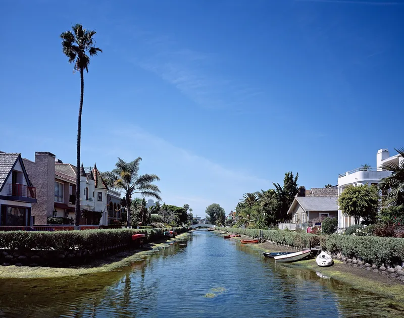
Six canals in the Venice area of Los Angeles form this district, which covers the public rights of way rather than the private houses beside them. Laid out in 1905 as the Short Line Beach Venice Canal Subdivision Number 1, the system includes four parallel canals about 1,100 feet long, a bordering Grand Canal and Eastern Canal. The channels have a trapezoidal cross section lined with clay, with concrete banks and walks, four concrete vehicular bridges and nine wooden pedestrian bridges. Railway executives Moses Sherman and Eli Clark sponsored the development, which was patterned after Venice, Italy and tied to the Venice Short Line railway. The canals to the north were filled and paved starting in 1929, which leaves this group as the major surviving portion of the system. The canals have kept their basic design since 1905, though silt, pollution and aging bridges have taken a toll. Adjacent housing is a mix of eras and was excluded from the boundary.
Significance in brief: The nomination argues the district is an early example of community and recreational planning in a coastal marshland area. It holds the major remaining portion of the Venice canal system and shows how railway builders Moses Sherman and Eli Clark paired transit with land development. The canal system is described as unique in the region and the state, and the six canals retain the integrity of the original development.
Machine-generated summary. This summary was generated by a language model from the official nomination document and has not been reviewed line by line by an editor. It may contain errors. Check the source document before relying on any detail. Source: nomination document (PDF) · National Archives catalog entry. NRHP reference 82002193, listed August 30, 1982. Summary generated October 2026 (model claude-sonnet-5-5, prompt v1.0-2026-10-29, confidence medium).
Key facts
| Address | Roughly bounded by Grand, Carroll, Eastern, and Sherman canals, Los Angeles |
|---|---|
| County | Los Angeles County |
| Listed | August 30, 1982 |
| Reference number | 82002193 |
| Resource type | District |
| Period of significance | 1905-1920 |
| Architect / builder | Moses Sherman/Eli Clark |
| Areas of significance | Community Planning and Development |
| Level of significance | State |
| Status (as stated in the nomination) | The canals are described as deteriorated, with silt, debris and pollutants, and the bridges, courts and sidewalks are substandard or deteriorated. They remain publicly owned and maintained by the City of Los Angeles. |
| Acreage | 12.1 |
| Coordinates | 33.98228, -118.46563 (NPS GIS) |
What listing means for this property
This is a historic district. Buildings within its boundary are either contributing (they add to the district's significance) or non-contributing. Owners of contributing income-producing buildings can claim the 20% federal rehabilitation tax credit; homeowners should look at state credits. National Register districts impose no design review by themselves; a local historic district ordinance, if one exists, does (the difference explained).
General information, not legal or tax advice. Rules change; confirm with your State Historic Preservation Office or a qualified adviser.
Sources and further reading
- National Park Service, National Register of Historic Places database (snapshot May 2026), reference 82002193.
- Nomination form (PDF, National Archives) — catalog entry
- Wikipedia article (used for cross-checking only; text not reproduced here)
- Wikidata Q7919977
- This listing as JSON
Last updated October 2026. Found an error? See the editorial policy for how to report it.