Wakamatsu Tea and Silk Colony Farm

Why it's listed
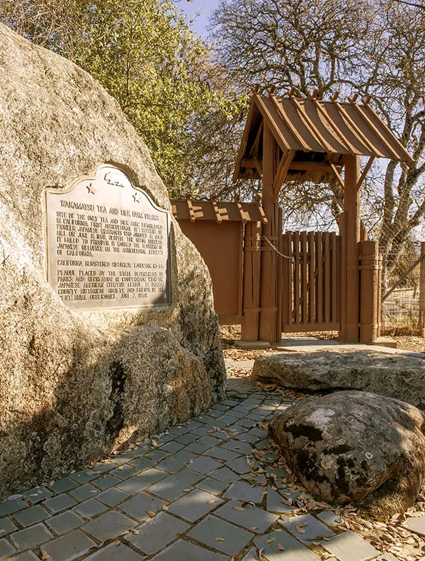
This farm in Gold Hill, El Dorado County, about two miles south of Coloma, was the site of the Wakamatsu Tea and Silk Colony. In 1869 agent John Henry Schnell bought the land and buildings from Charles Graner on behalf of Matsudaira Katamori, and Japanese colonists planted mulberry trees for silk and tea plants. They occupied the farm until 1871. A wood-framed two-story farmhouse, possibly dating to 1856, and a barn remain, along with a keaki tree the colonists planted, volunteer mulberries and a small pond they dug for fish culture. Fields still surround the buildings, and the setting closely matches an 1883 lithograph. The property is described as one of the oldest in North America tied to permanent Japanese settlement. It is also noted as the place where the first child of Japanese immigrants was born in the United States. Francis Veerkamp bought the land in 1873, and his descendants have farmed it since.
Significance in brief: The site is argued to be the location of the first permanent settlement of Japanese immigrants in the continental United States, occupied by the Wakamatsu colonists from 1869 to 1871. The colonists introduced sericulture and tea farming, marking the beginning of Japanese influence on California agriculture. The surrounding landscape retains remarkable integrity, and the nomination argues for national significance under Criterion A.
Machine-generated summary. This summary was generated by a language model from the official nomination document and has not been reviewed line by line by an editor. It may contain errors. Check the source document before relying on any detail. Source: nomination document (PDF) · National Archives catalog entry. NRHP reference 09000397, listed October 9, 2009. Summary generated October 2026 (model claude-sonnet-5-5, prompt v1.0-2026-10-29, confidence high).
Key facts
| Address | 941 Cold Springs Rd., Gold Hill |
|---|---|
| County | El Dorado County |
| Listed | October 9, 2009 |
| Reference number | 09000397 |
| Resource type | Site |
| Period of significance | 1869-1871 |
| Architectural style | No style - farmhouse vernacular |
| Criteria |
|
| Areas of significance | Asian, Exploration/Settlement, Agriculture |
| Level of significance | National |
| Status (as stated in the nomination) | Still in agricultural use as pastureland and farm; the house exterior retains excellent integrity, the barn has been remodeled, and the original mulberries have died, with 10-12 volunteers remaining. |
| Acreage | 54.3 |
| Coordinates | 38.76749, -120.88257 (NPS GIS) |
What listing means for this property
Sites (archaeological sites, battlefields, landscapes) are often listed with a restricted address to protect them from looting or disturbance. Listing is honorary for private owners; federal undertakings on or near the site go through Section 106 review, and state laws may protect burials and artefacts regardless of listing.
General information, not legal or tax advice. Rules change; confirm with your State Historic Preservation Office or a qualified adviser.
Sources and further reading
- National Park Service, National Register of Historic Places database (snapshot May 2026), reference 09000397.
- Nomination form (PDF, National Archives) — catalog entry
- Wikipedia article (used for cross-checking only; text not reproduced here)
- Wikidata Q11616376
- This listing as JSON
Last updated October 2026. Found an error? See the editorial policy for how to report it.