Hattie (Gold Bug), Priest and Silver Pine Mines and Stampmill
Also known as: Hangtown's Gold Bug Park

Why it's listed
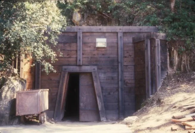
Hangtown's Gold Bug Park covers 61.45 acres on the eastern side of the Mother Lode near downtown Placerville, California. Four original mining claims make up the district, which holds the Hattie (Gold Bug), Priest and Silver Pine mines, an 8-stamp stamp mill, and a dam and pond. The Gold Bug tunnel runs 362 feet into hard slate and still shows the quartz veins that miners followed by blasting and hand tools. The Priest tunnel, 147 feet long, keeps visible tool marks on its walls. The stamp mill sits on its original site, with a frame designed by Joshua Hendy Iron Works, and once served custom crushing for local miners. Together these resources illustrate how gold was mined and processed from the Gold Rush into the twentieth century. The nomination points out that mining once drove Placerville's economy and that this complex is the last surviving local evidence of that activity. The city acquired the land in the 1960s and 1980s and developed it as a park.
Significance in brief: The district represents the range of technologies used to extract and process gold from the early Gold Rush years to the mid-twentieth century. The mines and stamp mill remain on their original sites in a setting that keeps much of its mining-era character. The nomination calls it the last remaining historical evidence in Placerville of what was once the community's major economic activity.
Machine-generated summary. This summary was generated by a language model from the official nomination document and has not been reviewed line by line by an editor. It may contain errors. Check the source document before relying on any detail. Source: nomination document (PDF) · National Archives catalog entry. NRHP reference 85003522, listed November 15, 1985. Summary generated October 2026 (model claude-sonnet-5-5, prompt v1.0-2026-10-29, confidence medium).
Key facts
| Address | 2501 Bedford Ave., Placerville |
|---|---|
| County | El Dorado County |
| Listed | November 15, 1985 |
| Reference number | 85003522 |
| Resource type | District |
| Period of significance | 1860-1920 |
| Areas of significance | Historic - Non-Aboriginal, Engineering |
| Level of significance | Local |
| Status (as stated in the nomination) | Owned by the City of Placerville and operated as a park with tours. The Gold Bug Mine is open to the public. The Priest Mine is closed after vandalism and slated for reopening. The Silver Pine Mine entrance is collapsed. The stamp mill building is deteriorated and awaiting restoration. |
| Acreage | 61.5 |
| Coordinates | 38.74399, -120.79844 (NPS GIS) |
What listing means for this property
This is a historic district. Buildings within its boundary are either contributing (they add to the district's significance) or non-contributing. Owners of contributing income-producing buildings can claim the 20% federal rehabilitation tax credit; homeowners should look at state credits. National Register districts impose no design review by themselves; a local historic district ordinance, if one exists, does (the difference explained).
General information, not legal or tax advice. Rules change; confirm with your State Historic Preservation Office or a qualified adviser.
Sources and further reading
- National Park Service, National Register of Historic Places database (snapshot May 2026), reference 85003522.
- Nomination form (PDF, National Archives) — catalog entry
- Wikidata Q141632320
- This listing as JSON
Last updated October 2026. Found an error? See the editorial policy for how to report it.