Point Richmond Historic District
Also known as: See Also:East Yard District
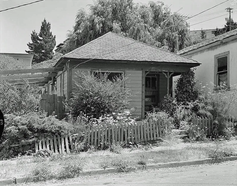

Why it's listed
Point Richmond is a hillside district of about 94 acres on the Potrero, a former island that became a peninsula as marshes filled in. Unlike many Bay Area towns, it began as a transportation and industrial center. In 1897 Santa Fe Railroad bought land here and built a terminal, yard, and a tunnel to a transbay ferry, with the first overland passenger train arriving in July 1900. The Standard Oil refinery opened in 1902 and drew workers who lived in modest housing nearby. Richmond's first city hall was located here after incorporation in 1905, though government and population shifted to the mainland by 1915. Development largely stopped in the 1920s, leaving small Queen Anne cottages, Neo-Classic row houses, bungalows, brick storefronts and churches. The 1906 First United Methodist Church and the 1910 Hotel Mac remain. Residents have restored many buildings, and the district keeps its identity as a distinct community.
Significance in brief: The district began as a transportation and industrial settlement tied to the Santa Fe Railroad terminus and the Standard Oil refinery. It was the nucleus of the City of Richmond and hosted its first city hall. It keeps a cohesive turn-of-the-century character of modest Victorian-era houses, brick commercial buildings and churches.
Machine-generated summary. This summary was generated by a language model from the official nomination document and has not been reviewed line by line by an editor. It may contain errors. Check the source document before relying on any detail. Source: nomination document (PDF) · National Archives catalog entry. NRHP reference 79000472, listed November 5, 1979. Summary generated October 2026 (model claude-sonnet-5-5, prompt v1.0-2026-10-29, confidence medium).
Key facts
| Address | Off CA 17, Richmond |
|---|---|
| County | Contra Costa County |
| Listed | November 5, 1979 |
| Reference number | 79000472 |
| Resource type | District |
| Architect / builder | Hotel Mac designed by architect W. O. Clausen (1910); most other buildings were built by small contractors or carpenters |
| Architectural style | Turn-of-the-century styles including Queen Anne, San Francisco Stick, Neo-Classic, Eastern and Brown Shingle, Craftsman Bungalow and California Bungalow |
| Areas of significance | Architecture |
| Level of significance | State |
| Status (as stated in the nomination) | Many older residential and commercial buildings have been restored or rehabilitated; the district remains a distinct community with some 1950s-60s apartment intrusions. |
| Coordinates | 37.92703, -122.38720 (NPS GIS) |
What listing means for this property
This is a historic district. Buildings within its boundary are either contributing (they add to the district's significance) or non-contributing. Owners of contributing income-producing buildings can claim the 20% federal rehabilitation tax credit; homeowners should look at state credits. National Register districts impose no design review by themselves; a local historic district ordinance, if one exists, does (the difference explained).
General information, not legal or tax advice. Rules change; confirm with your State Historic Preservation Office or a qualified adviser.
Sources and further reading
- National Park Service, National Register of Historic Places database (snapshot May 2026), reference 79000472.
- Nomination form (PDF, National Archives) — catalog entry
- Wikipedia article (used for cross-checking only; text not reproduced here)
- Wikidata Q7208152
- This listing as JSON
Last updated October 2026. Found an error? See the editorial policy for how to report it.