Shot Tower

Why it's listed
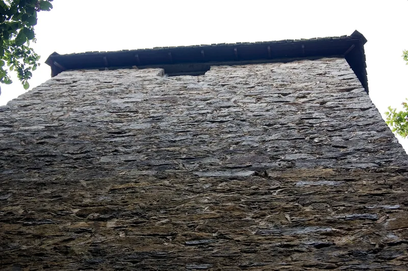
Rising seventy-five feet above the New River near Max Meadows, this square limestone tower was built about 1807 by Thomas Jackson to manufacture shot. Its walls are two and a half feet thick, the base measures twenty feet on a side, and a pyramidal roof tops the structure. Inside, wooden steps once led to a room with a fireplace and chimney, where molten lead was poured through a sieve into a shaft sunk seventy-five feet below the floor. The shot fell into a kettle of water, since the long drop was thought necessary to give it a round shape. A tunnel connected the shaft to the riverbank. Jackson used lead from his Austinville mines, four miles away, and the site sat near a ferry and a main regional road. Because no war was underway, the military market was small, so the shot served frontiersmen and settlers. It is one of only three shot towers remaining in the United States and possibly the only one of its kind in the world.
Significance in brief: The tower was built to make commercial shot from lead mined at Jackson's Austinville mines, supplying frontiersmen and settlers. It is one of only three shot towers remaining in the United States and possibly the only one of its kind in the world. The form describes it as a relic of an industry essential to opening America's frontier.
Machine-generated summary. This summary was generated by a language model from the official nomination document and has not been reviewed line by line by an editor. It may contain errors. Check the source document before relying on any detail. Source: nomination document (PDF) · National Archives catalog entry. NRHP reference 69000286, listed October 1, 1969. Summary generated October 2026 (model claude-sonnet-5-5, prompt v1.0-2026-10-29, confidence high).
Key facts
| Address | W of jct. of Rte. 608 and U.S. 52, Max Meadows |
|---|---|
| County | Wythe County |
| Listed | October 1, 1969 |
| Reference number | 69000286 |
| Resource type | Structure |
| Period of significance | 19th Century |
| Architect / builder | Thomas Jackson |
| Areas of significance | Industry, Architecture |
| Level of significance | State |
| Status (as stated in the nomination) | Condition is listed as fair, and the structure is owned by the Commonwealth of Virginia (Division of State Parks) and used as a historical park/museum. |
| Coordinates | 36.87016, -80.87032 (NPS GIS) |
What listing means for this property
National Register listing is honorary: it recognises significance and does not restrict what a private owner may do without federal money or permits. It unlocks the 20% federal rehabilitation tax credit for income-producing buildings, state credits in many states, and Section 106 review when federal agencies are involved. See what listing means in practice.
General information, not legal or tax advice. Rules change; confirm with your State Historic Preservation Office or a qualified adviser.
Sources and further reading
- National Park Service, National Register of Historic Places database (snapshot May 2026), reference 69000286.
- Nomination form (PDF, National Archives) — catalog entry
- Wikipedia article (used for cross-checking only; text not reproduced here)
- Wikidata Q6117101
- This listing as JSON
Last updated October 2026. Found an error? See the editorial policy for how to report it.