Smithfield
Also known as: VDHR File No. 83-12

Why it's listed
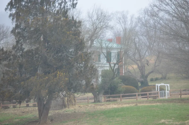
Smithfield is a 980-acre farm in the Elk Garden Creek bottom southwest of Rosedale, Russell County, Virginia, rising from the highway to the ridge of River Mountain. Its centerpiece is a two-story, five-bay Flemish-bond brick house built in the late 1850s, with a central passage, four rooms on each floor, and Greek Revival mantels and trim inspired by Asher Benjamin's pattern books. Around it stand a brick springhouse, an acetylene house, a meat house, and a former Rosedale schoolhouse moved to the farm, along with horse, sheep and cow barns, a shop, and a wagon shed. The property was settled by Colonel Henry Smith, and ownership stayed in the family for generations. That continuity preserved nineteenth-century field patterns and names. The farm is recognized for its agricultural history and for a house that shows how regional domestic forms changed from the mid-nineteenth to the mid-twentieth century.
Significance in brief: The house is argued to be one of Russell County's most important examples of mid-19th-century Greek Revival domestic architecture, adapted over time. The farm as a whole is significant in agriculture for retaining 19th-century field patterns and field names through continuous family ownership since the Revolutionary War era, along with barns and outbuildings showing post-Civil War adaptation.
Machine-generated summary. This summary was generated by a language model from the official nomination document and has not been reviewed line by line by an editor. It may contain errors. Check the source document before relying on any detail. Source: nomination document (PDF) · National Archives catalog entry. NRHP reference 94000988, listed August 16, 1994. Summary generated October 2026 (model claude-sonnet-5-5, prompt v1.0-2026-10-29, confidence medium).
Key facts
| Address | VA 19 NW side, 3 mi. SW of Rosedale, Rosedale |
|---|---|
| County | Russell County |
| Listed | August 16, 1994 |
| Reference number | 94000988 |
| Resource type | District |
| Period of significance | 1848-1940 |
| Architectural style | Greek Revival; central-passage-plan |
| Criteria |
|
| Areas of significance | Agriculture, Architecture |
| Level of significance | Local |
| Status (as stated in the nomination) | Current function listed as domestic and agricultural, with a vacant/not in use category also entered; barns range from good to poor condition. |
| Acreage | 980 |
| Coordinates | 36.95573, -81.98293 (NPS GIS) |
What listing means for this property
This is a historic district. Buildings within its boundary are either contributing (they add to the district's significance) or non-contributing. Owners of contributing income-producing buildings can claim the 20% federal rehabilitation tax credit; homeowners should look at state credits. National Register districts impose no design review by themselves; a local historic district ordinance, if one exists, does (the difference explained).
General information, not legal or tax advice. Rules change; confirm with your State Historic Preservation Office or a qualified adviser.
Sources and further reading
- National Park Service, National Register of Historic Places database (snapshot May 2026), reference 94000988.
- Nomination form (PDF, National Archives) — catalog entry
- Wikipedia article (used for cross-checking only; text not reproduced here)
- Wikidata Q15278246
- This listing as JSON
Last updated October 2026. Found an error? See the editorial policy for how to report it.