Anderson-Doosing Farm
Also known as: VDHR Flie No. 080-0009

Why it's listed
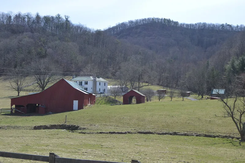
Set in the Catawba Valley of northern Roanoke County, this roughly 25-acre farm preserves the core of a once larger agricultural holding along the headwaters of Catawba Creek. The most prominent building is a two-story Greek Revival frame house built about 1883 for John and Barbara Ellen Doosing, with limestone chimneys, a symmetrical three-bay front and graining on interior doors. Lower on the property stands a double-crib log bank barn from about 1830, later enlarged with sheds and a straw shed. Other resources include a log cabin later used as a blacksmith shop, a log meat house with a reused door carved 1864, a corncrib, chicken houses, a 1940s cinder block milking parlor and a prehistoric archaeological site. The farm passed from the Andersons to Jacob Doosing in 1845, then to his nephew John W. Doosing, and in 1916 to the McNeil family, who ran a small blacksmith shop. Together the buildings document farm life from the early nineteenth century into the twentieth.
Significance in brief: The farm retains a largely intact set of domestic and agricultural buildings spanning from about 1830 to the mid-twentieth century, including a double-crib log barn, log cabin, meat house and blacksmith shop. It shows how a Catawba Valley farm evolved under the Anderson, Doosing and McNeil families. The nomination treats it as locally significant.
Machine-generated summary. This summary was generated by a language model from the official nomination document and has not been reviewed line by line by an editor. It may contain errors. Check the source document before relying on any detail. Source: nomination document (PDF) · National Archives catalog entry. NRHP reference 09000666, listed August 27, 2009. Summary generated October 2026 (model claude-sonnet-5-5, prompt v1.0-2026-10-29, confidence medium).
Key facts
| Address | 7474 VA 785, Catawba |
|---|---|
| County | Roanoke (city and county) |
| Listed | August 27, 2009 |
| Reference number | 09000666 |
| Resource type | District |
| Architectural style | Greek Revival |
| Areas of significance | Architecture |
| Level of significance | Local |
| Status (as stated in the nomination) | Current functions include single dwelling, secondary structure, agricultural storage and work in progress; some outbuildings show settling, leaning and deterioration. |
| Acreage | 25 |
| Coordinates | 37.33057, -80.19507 (NPS GIS) |
What listing means for this property
This is a historic district. Buildings within its boundary are either contributing (they add to the district's significance) or non-contributing. Owners of contributing income-producing buildings can claim the 20% federal rehabilitation tax credit; homeowners should look at state credits. National Register districts impose no design review by themselves; a local historic district ordinance, if one exists, does (the difference explained).
General information, not legal or tax advice. Rules change; confirm with your State Historic Preservation Office or a qualified adviser.
Sources and further reading
- National Park Service, National Register of Historic Places database (snapshot May 2026), reference 09000666.
- Nomination form (PDF, National Archives) — catalog entry
- Wikipedia article (used for cross-checking only; text not reproduced here)
- Wikidata Q15181014
- This listing as JSON
Last updated October 2026. Found an error? See the editorial policy for how to report it.