Freestone Point Confederate Battery
Also known as: DHL No. 76-264

Why it's listed
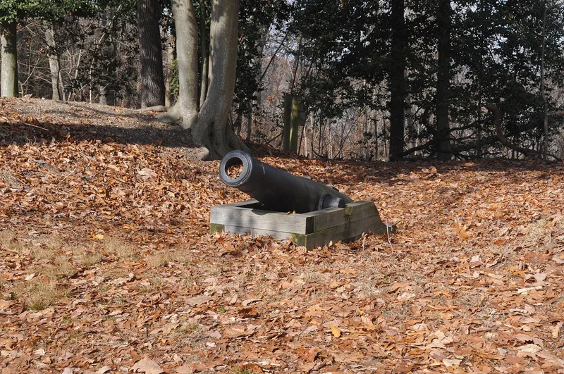
Four earthen gun emplacements sit on a cliff about 95 feet above the Potomac River in Leesylvania State Park. Built in September 1861, the Freestone Point battery was the northernmost of the Confederate batteries that blockaded the river. Each emplacement is a deep rectangular depression flanked by high earthen berms. Three are clustered on the cliff, and a fourth lies about 950 feet to the west, positioned to guard the mouth of Neabsco Creek. Smaller bermed depressions nearby may be the remains of ammunition magazines. On September 25, 1861, the battery exchanged fire with Union ships, and it fired again in October. The blockade lasted from October 1861 to March 1862 and embarrassed Union leaders. The battery was probably abandoned once stronger batteries were ready, and it may have been built partly as a ruse. Its designer and builder are unknown. Only this battery and Cockpit Point survive from the blockade. Park staff have cleared brush and are adding interpretive displays.
Significance in brief: The battery was the northernmost of the Confederate gun positions that blockaded the Potomac River, the Union's main supply route, from October 1861 to March 1862. It is one of only two surviving Potomac blockade batteries, the other being Cockpit Point. It may also have been built early to draw Union naval attention away from stronger batteries still under construction.
Machine-generated summary. This summary was generated by a language model from the official nomination document and has not been reviewed line by line by an editor. It may contain errors. Check the source document before relying on any detail. Source: nomination document (PDF) · National Archives catalog entry. NRHP reference 89001059, listed August 18, 1989. Summary generated October 2026 (model claude-sonnet-5-5, prompt v1.0-2026-10-29, confidence high).
Key facts
| Address | At Potomac River off VA 610 in Leesylvania State Park, Woodbridge |
|---|---|
| County | Prince William County |
| Listed | August 18, 1989 |
| Reference number | 89001059 |
| Resource type | Structure |
| Period of significance | 1861-1865 |
| Architectural style | Other: earthworks |
| Criteria |
|
| Areas of significance | Military |
| Level of significance | National |
| Status (as stated in the nomination) | Preserved within Leesylvania State Park, where staff have cleared vegetation and are developing interpretive displays; integrity is described as very good. |
| Acreage | 11 |
| Coordinates | 38.59280, -77.24893 (NPS GIS) |
What listing means for this property
National Register listing is honorary: it recognises significance and does not restrict what a private owner may do without federal money or permits. It unlocks the 20% federal rehabilitation tax credit for income-producing buildings, state credits in many states, and Section 106 review when federal agencies are involved. See what listing means in practice.
General information, not legal or tax advice. Rules change; confirm with your State Historic Preservation Office or a qualified adviser.
Sources and further reading
- National Park Service, National Register of Historic Places database (snapshot May 2026), reference 89001059.
- Nomination form (PDF, National Archives) — catalog entry
- Wikipedia article (used for cross-checking only; text not reproduced here)
- Wikidata Q15221106
- This listing as JSON
Last updated October 2026. Found an error? See the editorial policy for how to report it.