Smith Point Light Station

Why it's listed
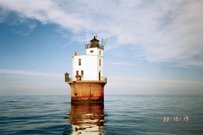
Smith Point Light Station is an offshore lighthouse standing in about 20 feet of water in the Chesapeake Bay, at the mouth of the Potomac River. Completed in 1897, it rests on a wooden caisson sunk into the shoal and topped by a 30-foot-diameter cast-iron cylinder filled with concrete. Above sits an octagonal two-story brick dwelling with a square tower and an iron lantern. Keeper's quarters, fuel storage and light are all part of one structure. It was built from the same plans as Wolf Trap Lighthouse. The site has been marked since 1802 by several onshore lighthouses, a screwpile lighthouse and lightships, as erosion and ice destroyed earlier structures. It is one of seven pneumatic caisson lighthouses built in the Bay and reflects federal efforts to protect shipping. The light was automated in 1971, and the Coast Guard replaced its power cable in 1988 after public demand. The Coast Guard still owns and manages it, and access is by boat.
Significance in brief: The nomination argues it reflects federal efforts to build an integrated system of navigational aids for safe shipping in the Chesapeake Bay. It also embodies the pneumatic caisson method of construction that typified Bay lighthouses in the late nineteenth century. It is one of seven pneumatic caisson lighthouses built in the Bay, and the site has been marked by five lighthouses and two lightships since 1802.
Machine-generated summary. This summary was generated by a language model from the official nomination document and has not been reviewed line by line by an editor. It may contain errors. Check the source document before relying on any detail. Source: nomination document (PDF) · National Archives catalog entry. NRHP reference 02001437, listed December 2, 2002. Summary generated October 2026 (model claude-sonnet-5-5, prompt v1.0-2026-10-29, confidence high).
Key facts
| Address | Bamboo Island, Smith Point |
|---|---|
| County | Northumberland County |
| Listed | December 2, 2002 |
| Reference number | 02001437 |
| Resource type | Structure |
| Period of significance | 1897-1952 |
| Architect / builder | U.S. Lighthouse Board |
| Architectural style | No Style |
| Criteria |
|
| Areas of significance | Maritime History, Transportation, Architecture |
| Level of significance | Local |
| Status (as stated in the nomination) | Owned and managed by the U.S. Coast Guard, still used as an active aid to navigation (automated in 1971); reached only by boat. |
| Acreage | 0.9 |
| Coordinates | 37.87985, -76.18365 (NPS GIS) |
What listing means for this property
For a publicly owned building or structure, listing mainly matters when federal funds, permits or licences are involved: projects then go through Section 106 review so effects on the property are considered. Listing also strengthens applications for preservation grants and, for leased income-producing uses, can enable the federal rehabilitation tax credit.
General information, not legal or tax advice. Rules change; confirm with your State Historic Preservation Office or a qualified adviser.
Sources and further reading
- National Park Service, National Register of Historic Places database (snapshot May 2026), reference 02001437.
- Nomination form (PDF, National Archives) — catalog entry
- Wikipedia article (used for cross-checking only; text not reproduced here)
- Wikidata Q7545272
- This listing as JSON
Last updated October 2026. Found an error? See the editorial policy for how to report it.