Cape Charles Light Station

Why it's listed
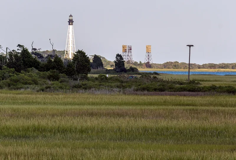
Cape Charles Light Station sits on Smith Island, reachable only by boat, at the southern tip of the Delmarva peninsula where it marks the entrance to Chesapeake Bay. Its 1894 octagonal, pyramidal tower is a cast-iron skeleton on concrete piers, with a central cylinder holding the spiral stair. At 191 feet, it is the tallest skeletal lighthouse in the country and the only onshore first-order cast-iron skeletal tower. It replaced earlier brick towers from 1828 and 1864; erosion forced the move to a new site. The station also retains a brick oil house and brick workshop from about 1895, while the keepers' quarters were lost to fire in 2000. Three World War II steel observation towers stand nearby but are noncontributing. The property was listed for its role in the federal system of navigational aids serving a major commercial shipping corridor and for the rare engineering of its tower. The light was automated in 1963 and continues to operate.
Significance in brief: The station is tied to federal efforts to build an integrated system of navigational aids for safe shipping in the Chesapeake Bay. Its 191-foot tower is described as the only onshore first-order cast-iron skeletal lighthouse in the United States, and the tallest skeletal tower in the country.
Machine-generated summary. This summary was generated by a language model from the official nomination document and has not been reviewed line by line by an editor. It may contain errors. Check the source document before relying on any detail. Source: nomination document (PDF) · National Archives catalog entry. NRHP reference 03000569, listed June 23, 2003. Summary generated October 2026 (model claude-sonnet-5-5, prompt v1.0-2026-10-29, confidence high).
Key facts
| Address | Smith Island, Kiptopke |
|---|---|
| County | Northampton County |
| Listed | June 23, 2003 |
| Reference number | 03000569 |
| Resource type | Structure |
| Period of significance | 1894-1952 |
| Architect / builder | U.S. Lighthouse Board |
| Architectural style | No Style |
| Criteria |
|
| Areas of significance | Maritime History, Transportation, Architecture |
| Level of significance | National |
| Status (as stated in the nomination) | The tower remains an active aid to navigation, automated in 1963. The keepers' quarters burned in July 2000, and the assistant keepers' homes were removed earlier. The brick oil house and workshop survive but are no longer Coast Guard property. |
| Acreage | 10 |
| Coordinates | 37.12293, -75.90624 (NPS GIS) |
What listing means for this property
For a publicly owned building or structure, listing mainly matters when federal funds, permits or licences are involved: projects then go through Section 106 review so effects on the property are considered. Listing also strengthens applications for preservation grants and, for leased income-producing uses, can enable the federal rehabilitation tax credit.
General information, not legal or tax advice. Rules change; confirm with your State Historic Preservation Office or a qualified adviser.
Sources and further reading
- National Park Service, National Register of Historic Places database (snapshot May 2026), reference 03000569.
- Nomination form (PDF, National Archives) — catalog entry
- Wikipedia article (used for cross-checking only; text not reproduced here)
- Wikidata Q5034646
- This listing as JSON
Last updated October 2026. Found an error? See the editorial policy for how to report it.