North Fork Valley Rural Historic District
Also known as: DHR File No. 60-574

Why it's listed
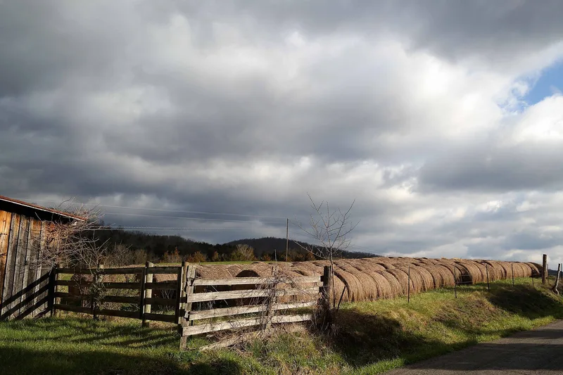
Stretching about nine miles along the North Fork of the Roanoke River in Montgomery County, Virginia, this rural district includes bottomland farms, steep wooded hollows and ridge-top clearings on Paris Mountain. It holds 144 contributing resources, including farmhouses, barns, three standing mills, two churches, an early twentieth-century school and the crossroads village of Lusters Gate. Settlement began in the 1740s and 1750s, and the earliest surviving houses are log dwellings, followed by brick Federal houses such as the Woods-Grubb House, antebellum center-passage houses with Greek Revival trim, and later farmhouses with sawn ornament. The 1850s McDonald Mill and the brick Bennetts Mill reflect local industry, and archaeological testing at the Woods-Grubb Farm found a smokehouse site and a tanyard. Several farms remain with descendants of early builders, and dairy and cattle operations continue on the valley floor, preserving a landscape shaped by successive farming methods.
Significance in brief: The nomination presents the valley as a largely intact rural landscape that shows farming and settlement patterns from the mid-1700s through the early twentieth century. It contains a notable collection of log, brick and frame farmhouses, agricultural outbuildings, mills and archaeological sites. Many farms are still worked by descendants of early families.
Machine-generated summary. This summary was generated by a language model from the official nomination document and has not been reviewed line by line by an editor. It may contain errors. Check the source document before relying on any detail. Source: nomination document (PDF) · National Archives catalog entry. NRHP reference 90002169, listed February 1, 1991. Summary generated October 2026 (model claude-sonnet-5-5, prompt v1.0-2026-10-29, confidence medium).
Key facts
| Address | Along the North Fork of the Roanoke R. from the Roanoke Co. line S to Lusters Gate, Blacksburg |
|---|---|
| County | Montgomery County |
| Listed | February 1, 1991 |
| Reference number | 90002169 |
| Resource type | District |
| Architectural style | Greek Revival; also single pen and parlor plan and center passage plan dwellings |
| Areas of significance | Historic - Non-Aboriginal, Agriculture, Architecture |
| Level of significance | Local |
| Status (as stated in the nomination) | Most farms in the bottomland remain in use for cattle, dairy and hay, while many upland farms are abandoned or used as tenant dwellings, hunting lodges or seasonal cottages. The 1930s cheese factory is vacant. |
| Acreage | 10200 |
| Coordinates | 37.26882, -80.31637 (NPS GIS) |
What listing means for this property
This is a historic district. Buildings within its boundary are either contributing (they add to the district's significance) or non-contributing. Owners of contributing income-producing buildings can claim the 20% federal rehabilitation tax credit; homeowners should look at state credits. National Register districts impose no design review by themselves; a local historic district ordinance, if one exists, does (the difference explained).
General information, not legal or tax advice. Rules change; confirm with your State Historic Preservation Office or a qualified adviser.
Sources and further reading
- National Park Service, National Register of Historic Places database (snapshot May 2026), reference 90002169.
- Nomination form (PDF, National Archives) — catalog entry
- Wikipedia article (used for cross-checking only; text not reproduced here)
- Wikidata Q14712972
- This listing as JSON
Last updated October 2026. Found an error? See the editorial policy for how to report it.