New Point Comfort Lighthouse

Why it's listed
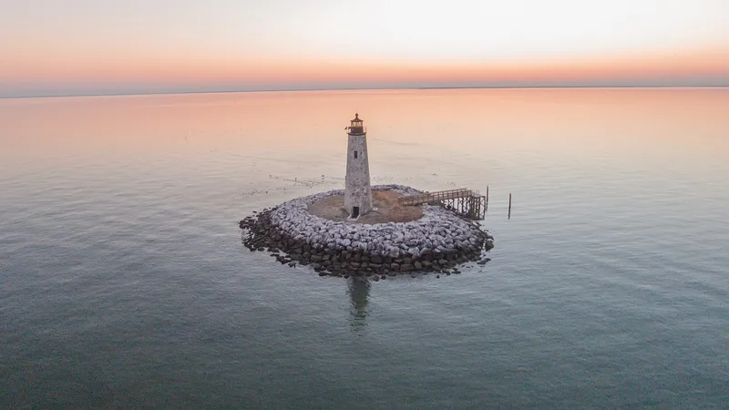
New Point Comfort Lighthouse is an octagonal sandstone tower on a small granite rubble island at the southern tip of Mathews County, Virginia. The island, now about one-third of an acre, was once part of a peninsula joined to the mainland before erosion cut it off. Congress authorized a permanent light here in 1801 because the point and its shoals threatened ships entering Mobjack Bay. Elzy Burroughs of Mathews County built the tower and a dwelling under a 1802 contract for $8,750. The light was finished by 1805 and first used in 1806. Inside, a stone spiral stair, comparable to the one at the 1802 Old Point Comfort Light, winds up to the lantern. An automatic light replaced the old mechanism in 1930, and a new offshore light took over in 1963. The abandoned tower has since suffered neglect and vandalism, though its masonry remains sound and it still serves as a daytime landmark for boaters.
Significance in brief: The tower is an architecturally notable early federal lighthouse, similar to the 1802 Old Point Comfort Light and containing a stone spiral stair. It marked a long-standing navigational hazard at the entrance to Mobjack Bay. Its history includes the 1801 Congressional act, construction by Elzy Burroughs, and service until the Coast Guard discontinued it in 1963.
Machine-generated summary. This summary was generated by a language model from the official nomination document and has not been reviewed line by line by an editor. It may contain errors. Check the source document before relying on any detail. Source: nomination document (PDF) · National Archives catalog entry. NRHP reference 73002037, listed March 1, 1973. Summary generated October 2026 (model claude-sonnet-5-5, prompt v1.0-2026-10-29, confidence high).
Key facts
| Address | Jct. of Chesapeake Bay and Mobjack Bay, New Point |
|---|---|
| County | Mathews County |
| Listed | March 1, 1973 |
| Reference number | 73002037 |
| Resource type | Building |
| Architect / builder | Elzy Burroughs of Mathews County (builder under contract with the Federal Government) |
| Areas of significance | Transportation, Architecture |
| Level of significance | State |
| Status (as stated in the nomination) | Abandoned as an operating Coast Guard facility after 1963; neglected and vandalized, with windows boarded and the lantern glass broken, but the stonework is in good condition and the structure is generally sound. The keeper's house disappeared before 1963. |
| Acreage | 9 |
| Coordinates | 37.30109, -76.27770 (NPS GIS) |
What listing means for this property
For a publicly owned building or structure, listing mainly matters when federal funds, permits or licences are involved: projects then go through Section 106 review so effects on the property are considered. Listing also strengthens applications for preservation grants and, for leased income-producing uses, can enable the federal rehabilitation tax credit.
Noted as vacant in the nomination. Nomination documents can be decades old; current status may differ. If you are considering buying an empty listed property, read the due-diligence checklist.
General information, not legal or tax advice. Rules change; confirm with your State Historic Preservation Office or a qualified adviser.
Sources and further reading
- National Park Service, National Register of Historic Places database (snapshot May 2026), reference 73002037.
- Nomination form (PDF, National Archives) — catalog entry
- Wikipedia article (used for cross-checking only; text not reproduced here)
- Wikidata Q7011017
- This listing as JSON
Last updated October 2026. Found an error? See the editorial policy for how to report it.