Clapham's Ferry
Also known as: Spinks Ferry; Lost Corner Farm; Riverside; DHR File No. 53-7
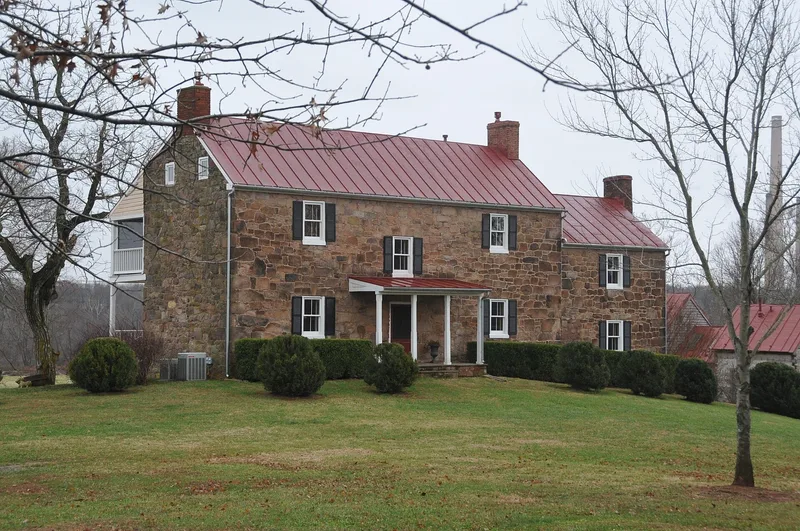

Why it's listed
Clapham's Ferry is a 355-acre farm on the Potomac River near Leesburg, Virginia, centered on a two-and-one-half-story red sandstone house with a two-story stone kitchen wing. Nearby are a log kitchen, a log meat house, a large bank barn and a corn crib. The Virginia Legislature authorized Josias Clapham to operate a public ferry across the Potomac to Maryland in 1757. The Claphams ran it intermittently until 1816, when William Hawling took it over. It passed to John Spinks in 1833 and operated until about the Civil War. Nothing remains at the ferry landing except scattered debris. The stone house, probably built in the early nineteenth century, retains its Federal interior woodwork and original mantels. The nomination values it as one of the most intact early rural dwellings with outbuildings in Loudoun County. The bank barn, among the county's largest, reflects a productive grain and cattle operation on the river bottomland.
Significance in brief: The nomination argues the property is historically significant as the site of an early ferry crossing between Loudoun County and Maryland. It is architecturally significant as one of the most intact early nineteenth-century rural dwellings with outbuildings in Loudoun County. The stone house probably served as the ferry owner's residence and the center of a successful farm.
Machine-generated summary. This summary was generated by a language model from the official nomination document and has not been reviewed line by line by an editor. It may contain errors. Check the source document before relying on any detail. Source: nomination document (PDF) · National Archives catalog entry. NRHP reference 97001076, listed September 4, 1997. Summary generated October 2026 (model claude-sonnet-5-5, prompt v1.0-2026-10-29, confidence high).
Key facts
| Address | 44344 E. Spinks Ferry Rd., Leesburg |
|---|---|
| County | Loudoun County |
| Listed | September 4, 1997 |
| Reference number | 97001076 |
| Resource type | Building |
| Period of significance | 1757-1900 |
| Architect / builder | Unknown |
| Architectural style | Early Republic: Federal |
| Criteria |
|
| Areas of significance | Architecture, Transportation |
| Level of significance | Local |
| Status (as stated in the nomination) | The ferry site has no remaining structures. The house complex survives, with a tenant house and a poultry house deemed noncontributing. The dwelling and farm buildings are listed as current domestic and agricultural uses. |
| Acreage | 354.9 |
| Coordinates | 39.22232, -77.46406 (NPS GIS) |
What listing means for this property
National Register listing is honorary: it recognises significance and does not restrict what a private owner may do without federal money or permits. It unlocks the 20% federal rehabilitation tax credit for income-producing buildings, state credits in many states, and Section 106 review when federal agencies are involved. See what listing means in practice.
General information, not legal or tax advice. Rules change; confirm with your State Historic Preservation Office or a qualified adviser.
Sources and further reading
- National Park Service, National Register of Historic Places database (snapshot May 2026), reference 97001076.
- Nomination form (PDF, National Archives) — catalog entry
- Wikipedia article (used for cross-checking only; text not reproduced here)
- Wikidata Q14712176
- This listing as JSON
Last updated October 2026. Found an error? See the editorial policy for how to report it.